
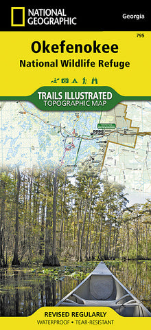
Okefenokee National Wildlife Refuge, Map 795 by National Geographic Maps
• Waterproof • Tear-Resistant • Topographic Map
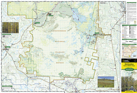
Covering 630 square miles in southeast Georgia, the Okefenokee National Wildlife Refuge encompasses nearly all of the world-renowned Okefenokee Swamp. Expertly researched and created in partnership with local land management agencies, National Geographics Trails Illustrated map of Okefenokee National Wildlife Refuge provides an unparalleled tool for exploring this magnificent wetland. This map offers unmatched detail of the entire park and features key areas of interest including Stephen C. Foster State Park; Suwannee River Sill Recreation Area; Okefenokee Swamp Park; Kingfisher Landing; and Laura S. Walker State Park.
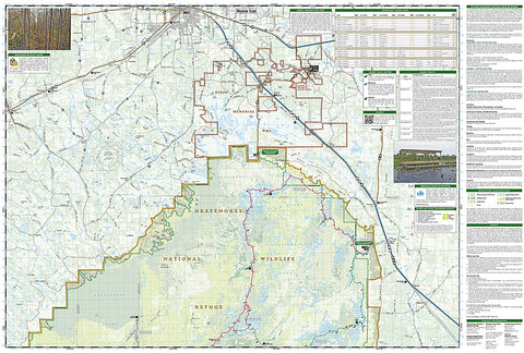
Designed with a wide range of visitors in mind, this map features detailed topography with shaded relief and vegetation classification; accurate road network including Okefenokee Trail and Swamp Island Drive auto tours; visitor centers and facilities; safety tips; and agency contact information. Paddling is the best way to explore the refuge in depth, and this map is loaded with information specific to that activity including color-coded canoe trails, trail mileage, difficulty ratings, and charts of canoe trails and overnight canoe trips. Many recreation features are noted as well, including campgrounds, boat ramps, shooting ranges, and areas for wildlife viewing, water skiing, biking, paddling, fishing, and swimming. Includes Okefenokee Swamp.
Every Trails Illustrated map is printed on Backcountry Tough waterproof, tear-resistant paper. A full UTM grid is printed on the map to aid with GPS navigation.
- Product Number: 2139946M
- Product Code: TI_OKEFENOKEE
- Publisher Product ID: TI00000795
- ISBN: 9781566956277
- Year of Publication: 2013
- Folded Size: 9.45 x 4.33 inches
- Unfolded Size: 24.8 x 33.07 inches
- Map type: Folded Map
- Geographical region: Georgia (USA)


