
France Adventure Map 3313
• Waterproof • Tear-Resistant • Travel Map
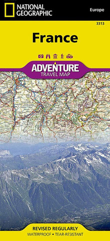
National Geographics France AdventureMap is designed to meet the unique needs of adventure travelers with its durability and accurate information. This folded map provides global travelers with the perfect combination of detail and perspective, highlighting hundreds of points of interest and the diverse and unique destinations within the country.
The map includes the locations of cities and towns with a user-friendly index, plus a clearly marked road network complete with distances and designations for major highways, main roads, and tracks and trails for those seeking to explore more remote regions.
The front side of the France map details the southern region of the country (including Corsica), from its border with Germany, Switzerland and Italy to the east, to the Bay of Biscay, Golfe de Gascogne to the west, and extending south to the Mediterranean Sea, Monaco, Golfe du Lion, Spain and Andorra. The reverse side of the m
- Product Number: NG_AM_F_22
- Reference Product Number: - None -
- ISBN: 9781566956048
- Date of Publication: 6/1/2022
- Folded Size: 9.06 inches high by 4.33 inches wide
- Unfolded (flat) Size: 37.8 inches high by 25.59 inches wide
- Map format: Folded
- Map type: Trade Maps - Travel
- Geographical region: France


