
France, Belgium, and The Netherlands, Executive, Sleeved by National Geographic Maps
Click to Zoom (high resolution)
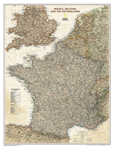
National Geographics Executive style wall map of France, Belgium and The Netherlands is beautifully rendered with unparalleled detail using an antique inspired color palette. The stunning shaded relief is complemented by clearly defined international boundaries, national subdivisions, thousands of place names, national parks, swamps, glaciers, intermittent lakes, mountain passes, areas of sand and land below sea level. In addition, major infrastructure networks are displayed such as airports, highways and roads, oil fields and pipelines, high-speed railway lines, canals and ferry routes. Luxembourg and portions of the United Kingdom, Germany, Switzerland, Spain, and Italy are shown as well.
- Product Number: 2058002M
- Product Code: NG_F_E_WA_S
- Publisher Product ID: RE01020459
- ISBN: 9781597752862
- Year of Publication: 2009
- Unfolded Size: 26.77 x 19.88 inches
- Map type: Wall Map
- Geographical region: France


