
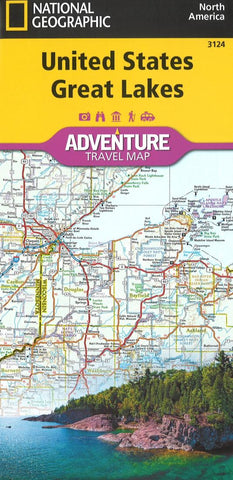
U.S. Great Lakes Adventure Map (3124) by National Geographic Maps
There are few nations as vast and spectacularly diverse as the United States of America. From the Atlantic to the Pacific, America the Beautiful offers boundless destinations and experiences for travelers seeking outdoor adventures, small town delights, or the excitement of urban culture.
The United States Great Lakes Adventure Map will guide you to the five Great Lakes of Superior, Michigan, Huron, Erie, and Ontario. This region of the country has used the Great Lakes as a pathway for exploration, trade and recreation for hundreds of years and these traditions still thrive as witnessed by the cities and towns that border the Great Lakes. The states of Minnesota, Wisconsin, Illinois, Michigan, Indiana, Ohio, Pennsylvania, and New York all benefit from their contact with the largest freshwater lake system on Earth. The map includes the cities of Duluth, Milwaukee, Chicago, Detroit, Toledo, Cleveland, Erie, and Buffalo on the American side with Toronto, Kingston, and Windsor on the Canadian side, and the breathtaking Niagara Falls in between. There is simply no better map for exploring the states bordering the Great Lakes.
National Geographics US Adventure Maps provide the most authoritative and convenient travel maps available to plan and guide your USA Adventure. Each map delivers the perfect combination of detail and perspective, highlighting travel routes, topography, and points of interest for those venturing beyond the city centers. Whether youre on a classic American road trip or planning a grand tour to visit several cities or national parks, these maps offer the ultimate geographic resource as only National Geographic can provide.
Every Adventure Map is printed on durable synthetic paper, making them waterproof, tear-resistant and tough - capable of withstanding the rigors of international travel.
- Product Number: 2259280M
- Product Code: NG_AM_US_3124
- ISBN: 9781566957182
- Year of Publication: 2017
- Folded Size: 9.45 x 4.330 inches
- Unfolded Size: 29.13 x 24.8 inches
- Map type: Folded Map
- Geographical region: Australia


