
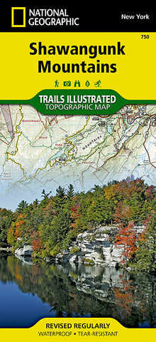
Shawangunk Mountains, TI 750 by National Geographic Maps
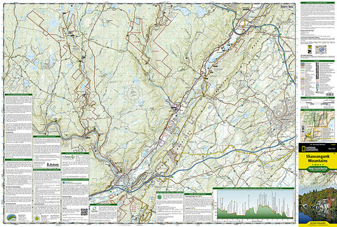
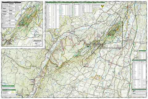
Created in cooperation with local and national land management agencies and preservation organizations, National Geographics Trails Illustrated map of Shawangunk Mountains is a comprehensive guide to the regions recreational opportunities. With background information about the areas various public lands, detailed trail charts, a profile of the Shawangunk Ridge Trail, a guide to the key points of interest, a complete road network, scenic byways and hundreds pinpointed recreation features, as well as navigation features such as contour lines, elevations, labeled peaks and summits, selected waypoints, this map can guide all outdoor enthusiasts on their adventure.
Trail guides list each trail with mileage and designated usage, whether hiking, horseback riding, biking or cross-country skiing. Mapped trails are shown with mileage indicators between intersections, including the Long Path and Shawangunk Ridge Trail, both of which are highlighted. The Shawangunk Ridge Trail profile displays elevations and distances along the trail as well as key points of interest. Some recreation features are trailheads, interpretive trails, boat launches, campgrounds, primitive campsites and areas for fishing, swimming, scuba diving, climbing, picnicking and wildlife viewing. Coverage includes Minnewaska State Park and Sams Point Preserves, Neversink and Upper Delaware River, High Point State Park, Shawangunk Mountain Scenic Byway and Bashakill WMA. An inset map provides extra detail of Mohonk Preserve and Mohonk Mountain House.
Every Trails Illustrated map is printed on Backcountry Tough waterproof, tear-resistant paper. A full UTM grid is printed on the map to aid with GPS navigation.
Other features found on this map include: High Point, Kittatinny Mountain, Middletown, Neversink River, Plattekill, Shawangunk Mountains, Upper Delaware, Wawarsing.
- Product Number: 2242988M
- Product Code: TI_NY_750
- Publisher Product ID: TI00000750
- ISBN: 9781566956819
- Year of Publication: 2014
- Folded Size: 9.45 x 4.33 inches
- Unfolded Size: 26.38 x 37.8 inches
- Map type: Folded Map
- Geographical region: New York


