
Hawaiian Islands by Borch GmbH.
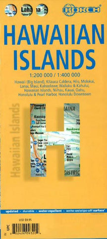
This soft-laminated folded map of Hawaii shows: Hawaii (Big Island) 1:400 000, Kilauea Caldera 1:150 000, Hilo 1:70 000, Maui, Molokai / Lanai / Kahoolawe 1:200 000, Wailuku & Kahului 1:35 000, Hawaiian Islands 1:4 000 000, Niihau 1:400 000, Kauai / Oahu 1:200 000, Honolulu & Pearl Harbour 1:26 000, Honolulu Downtown 1:15 500, USA administrative & time zones. Borch Maps are easy to fold, durable and water-repellent with a wipeable surface. Borch Maps show hotels, museums, monuments, markets, public transport, top sights and points of interest, useful statistics, conversion charts for temperatures, weights and measurements, climate charts showing temperatures, sunshine hours, precipitation and humidity, overview maps, time zones, and much more...
Borne of fire and water barely 300 million years ago, the eight islands of the Hawaiian Archipelago together form the 50th US state of Hawaii, the only state not located on the North American continent. Situated in the mid-Pacific, Hawaii is the only state besides Alaska that is not bordered by another US state. The Hawaiian language has unfortunately become almost obsolete, but the roots of todays hula-hula dance, surf-riding and the lovely leis are firmly anchored in Hawaiis age-old heritage and traditions, which today play an increasingly important role as this state strives to retain its unique cultural heritage. Be welcomed with a friendly aloha and a colorful lei and step into the splendour of an unforgettable island paradise. Or, as Mark Twain described the islands: The most charming fleet of islands that ever set sail!
- Product Number: 2228474M
- Product Code: BOR_HI
- ISBN: 9783866093201
- Year of Publication: 2016
- Folded Size: 9.45 x 4.33 inches
- Unfolded Size: 18.7 x 31.1 inches
- Map type: Folded Map
- Geographical region: Hawaii


