
San Francisco, California by Red Maps
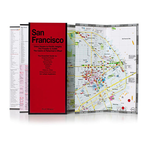
San Francisco on a tourist street plan from Red Maps presented in a handy concertina format and printed on thick high quality paper, with thematic indexes for hotels, restaurants, shopping, museums, theatres, etc.
The plan provides coverage of the central districts of the city extending from the beaches along the Pacific, across the Golden Gate Park and the downtown area to the San Francisco Bay waterfront. North/south the map extends from the Fishermans Wharf and the entrance onto the Golden Gate Bridge to Castro. On the reverse the downtown area is shown in greater detail. Also provided is a small road map of the Bay Area.
The plan names tourist sights, entertainment venues, selected hotels and restaurants, etc. Also highlighted are main shopping streets. Muni/BART and cable car connections are very clearly indicated.
The plan is accompanied by several lists and recommendations: hotels, restaurants and shops arranged by district, museums and libraries, etc. The index lists only a selection of neighborhoods and streets.
- Product Number: 2186079M
- Product Code: RED_SAN_FR
- ISBN: 9781892238771
- Year of Publication: 2015
- Folded Size: 9.45 x 3.94 inches
- Unfolded Size: 8.66 x 22.83 inches
- Map type: Folded Map
- Geographical region: California


