
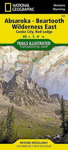


Absaroka-Beartooth Wilderness, East, Map 722 by National Geographic Maps
• Waterproof • Tear-Resistant • Topographic Map
National Geographics Trails Illustrated map of Absaroka-Beartooth Wilderness East delivers extensive detail and valuable information to assist you in your exploration of this breathtaking wilderness. The areas unique terrain, with snowcapped peaks, glaciers, alpine lakes and plateaus is the maps core feature, with detailed elevation contours, shaded relief, vegetation, and water features. Expertly researched and created in partnership with local land management agencies, the map features key points of interest including East Rosebud; Mystic Lake; Stillwater River; Cooke City; Red Lodge; Beartooth Highway Scenic Byway; and portions of Gallatin, Custer, and Shoshone national forests.
This map can guide you off the beaten path and back again with over 700 miles of mapped trails including trails for hiking, cross-country skiing, horseback riding, and snowmobiling. Trail mileage between intersections will help you choose the path thats right for you. Recreation features are clearly marked including campgrounds, trailheads, ski areas, fishing and boat access, and points of interest. A variety of helpful information about stock use, recommended backcountry camp setup, and bear safety tips are included as well.
Every Trails Illustrated map is printed on Backcountry Tough waterproof, tear-resistant paper. A full UTM grid is printed on the map to aid with GPS navigation.
Other features found on this map include: Absaroka-Beartooth Wilderness, Beartooth Mountains, Castle Mountain, Cathedral Peak, Custer National Forest, Gallatin National Forest, Granite Peak, Granite Range, North Absaroka Wilderness, Pilot Peak, Shoshone National Forest, Silver Run Plateau, Yellowstone National Park.
Map Scale = 1:70,000
- Product Number: 2132773M
- Product Code: TI_BEARTOOTH_E
- Publisher Product ID: TI00000722
- ISBN: 9781566955829
- Year of Publication: 2013
- Folded Size: 9.45 x 4.330 inches
- Unfolded Size: 24.8 x 37.01 inches
- Map type: Folded Map
- Geographical region: United States


