
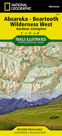


Absaroka-Beartooth Wilderness, West, Map 721 by National Geographic Maps
Waterproof, tear-resistant, topographic map of Absaroka-Beartooth Wilderness West is designed to meet the needs of outdoor enthusiasts with durability and detail. This map was created in cooperation with local land management agencies and is loaded with valuable recreation information from the mountain peaks to the deep canyons below. Trails and major roads are clearly distinguished. Places of interest include lakes, glaciers, and campgrounds. Boundaries for park lands, wilderness, and protected areas are color coded and easy to discern. The areas unique terrain, with ragged rock peaks and sheer rock walls in the Beartooths and dense forests and alpine meadows in the Absarokas, is the maps core feature, with detailed elevation contours, shaded relief, vegetation, and water features.
The front side of the map focuses on the northern portion of the wilderness, beginning at the peaks east of the Paradise Valley between Livingtson and Emigrant, and over to Custer National Forest. It includes the Yellowstone River and Yellowstone Ranger District Boundaries. Flip over to the backside for the southern portion of the wilderness, from Dome Mountain Wilderness Management Area to the Blacktail Deer Plateu across the Wyoming state line.
The Absaroka-Beartooth Wilderness West map is designed and printed in the United States on durable synthetic paper, making it waterproof, tear-resistant, and trail tough -- capable of going anywhere you do.
- Product Number: 2132765M
- Product Code: TI_BEARTOOTH_W
- Publisher Product ID: TI00000721
- ISBN: 9781566955812
- Year of Publication: 2013
- Folded Size: 9.45 x 4.330 inches
- Unfolded Size: 24.8 x 37.01 inches
- Map type: Folded Map
- Geographical region: United States


