
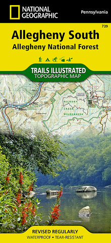
Allegheny National Forest, South, Map 739 by National Geographic Maps
• Waterproof • Tear-Resistant • Topographic Map
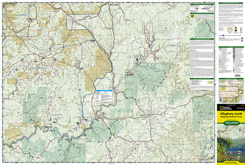
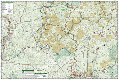
Explore the forests, valleys, and winding rivers of northwestern Pennsylvania with National Geographics Trails Illustrated map of Allegheny South. Expertly researched and created in partnership with local land management agencies, this map is a valuable tool for those seeking a relaxing day trip and outdoor adventurers alike. Key areas of interest featured on this map include Hickory Creek Wilderness; Elk, Oil Creek, Cook Forest, and Clear Creek state parks; Buzzard Swamp; Allegheny Islands Wilderness; and Tionesta and Hearts Content scenic areas.
Like all Trails Illustrated maps, this map features detailed topography with shaded relief, elevations, and clearly defined, color-coded boundaries for parks, forests, wilderness areas, and wildlife management areas. With miles of mapped hiking, biking, snowmobile, equestrian, and cross country ski trails including a portion of the North Country Trail and the Allegheny Snowmobile Loop, this map can guide you off the beaten path and back again in some of the most scenic landscapes in the region. Trail mileage between intersections is marked, as well as river mileage on the Clarion and Allegheny rivers, for those exploring by boat. Additional information about hazards and portage on the Clarion River is included as well. Some of the recreation features highlighted include boat launches, fishing and swimming areas, campgrounds, picnic areas, and interpretive trails.
Every Trails Illustrated map is printed on Backcountry Tough waterproof, tear-resistant paper. A full UTM grid is printed on the map to aid with GPS navigation.
Other features found on this map include: Allegheny National Forest, East Branch Clarion River, Hickory Creek Wilderness, Tionesta Lake.
- Product Number: 2130068M
- Product Code: TI_PA_739
- Publisher Product ID: TI00000739
- ISBN: 9781566956321
- Year of Publication: 2013
- Folded Size: 9.45 x 4.33 inches
- Unfolded Size: 37.01 x 24.8 inches
- Map type: Folded Map
- Geographical region: Pennsylvania


