
Croatia Adventure Map 3324 by National Geographic Maps
• Waterproof • Tear-Resistant • Travel Map
Called the jewel of the Adriatic Sea, Croatias medieval cities, turquoise waters, and rugged mountains make this small Mediterranean county big on adventure. National Geographics Croatia Adventure Map will meet the needs of travelers with its detailed, accurate information. The map includes the locations of exotic places to discover including Trogir, Dubrovnik, and Mostar, with a user-friendly index, clearly marked road network complete with distances and designations for roads/highways, plus secondary routes for those seeking to explore off the beaten path. With specialty content to include hundreds of diverse and unique recreational, ecological, cultural, and historical destinations, this map is a perfect companion to a guidebook.
Start your adventure in one of Croatias premier national parks; the waterfalls of Plitvice, the forests of Krka and Mljet, or the mountain caverns of Paklenica. Visit the two most beautiful rivers in Europe, the Zrmanja and Krupa, or kayak your way to one of the Elafiti islands in the Adriatic Sea. Along the way youll see Diocletians palace in Split, Biokovo Mountain, and shared borders regions with Slovenia, Hungary, Serbia, Bosnia and Herzogovina.
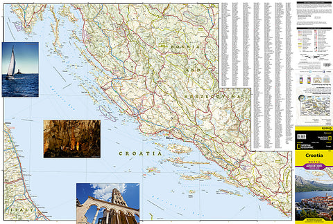
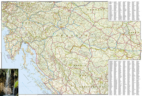
The southern portion of the country from the island of Krk to the border of Montenegro is shown on the front side. The reverse side details from the Croatian borders with Slovenia and Hungary in the north and Serbia and Bosnia and Herzogovina in the east, and overlaps the front side south to the Dalmatian cities of Zadar and Knin.
Every Adventure Map is printed on durable synthetic paper, making them waterproof, tear-resistant and tough - capable of withstanding the rigors of international travel.
Map Scale = 1:500,000
- Product Number: 2127739M
- Product Code: NG_AM_CRO
- Publisher Product ID: AD00003324
- ISBN: 9781566956437
- Year of Publication: 2013
- Folded Size: 9.45 x 4.330 inches
- Unfolded Size: 24.8 x 36.61 inches
- Map type: Folded Map
- Geographical region: Croatia


