


Banff, North, including Banff and Yoho Natl Parks, Map 901 by National Geographic Maps
• Waterproof • Tear-Resistant • Topographic Map
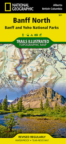
National Geographics Trails Illustrated map of Banff North delivers extensive detail for outdoor enthusiasts exploring the unparalleled mountain scenery and abundance of recreational opportunities of the Canadian Rockies. Expertly researched and created in cooperation with Parks Canada and others, the map covers the northern and western areas of Banff National Park as well as Yoho and Kootenay National Parks, Siffleur and White Goat Wilderness Areas, Kootenay Plains Provincial Park and the southeastern tip of Jasper National Park. Many popular recreation points of interest are shown, including Lakes Louise and OHara as well as the scenic Icefields Parkway, displayed with distance markers.
Explore the area by following the map to trailheads and then along precisely mapped trails, shown with distance markers in miles and kilometers and labeled for hiking, biking and horseback riding. To aid in your navigation the map shows glaciers and icefields, contour lines and elevations, labeled peaks and passes, areas of rock debris and water features. Find suitable areas for exploration, according to your area of interest, with labeled campgrounds and campsites, backcountry lodging and cabins, horse camps and corrals, biking and skiing areas, river access points, fishing areas, lookout towers and scenic viewpoints. The map also includes background information about the area, bear safety tips and essential contact information.
Every Trails Illustrated map is printed on Backcountry Tough waterproof, tear-resistant paper. A full UTM grid is printed on the map to aid with GPS navigation.
Other features found on this map include: Banff National Park, Lake Louise.
Map Scale = 1:100,000
- Product Number: 2060095M
- Product Code: TI_BANFF_N
- Publisher Product ID: TI00000901
- ISBN: 9781566956598
- Year of Publication: 2014
- Folded Size: 9.45 x 4.330 inches
- Unfolded Size: 24.8 x 37.01 inches
- Map type: Folded Map
- Geographical region: Canada


