
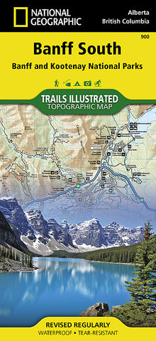


Banff South including Banff and Kootenay National Parks by National Geographic Maps
• Waterproof • Tear-Resistant • Topographic Map
National Geographics Trails Illustrated map of Banff South delivers extensive detail for outdoor enthusiasts exploring the unparalleled mountain scenery and year-round recreational opportunities in the Canadian Rockies. Expertly researched and created in cooperation with Parks Canada and others, the map covers the southern and eastern areas of Banff National Park including popular points of interest Lake Minnewanka, Bow River, Johnston Canyon and the town of Banff. The map also covers Kootenay National Park; Scalp Creek Nature Area; Panther Corner, Dormer Sheep and Ghost PLUZs; Wild Horse and Red Deer River Recreation Areas; Height of the Rockies, Don Getty and Bow Valley Wildland Provincial Parks; Ghost River Wilderness Area; and Mount Assiniboine.
Explore the area by following the map to trailheads and then along precisely mapped trails, shown with distance markers in miles and kilometers and labeled for hiking, biking and horseback riding. To aid in your navigation the map shows glaciers and icefields, contour lines and elevations, labeled peaks and passes and water features. Find suitable areas for exploration, according to your area of interest, with labeled campgrounds and campsites, horse camps and corrals, hot springs, river access points, scenic viewpoints, interpretive trails and areas for hiking, cross-country and downhill skiing, biking, fishing.
Every Trails Illustrated map is printed on Backcountry Tough waterproof, tear-resistant paper. A full UTM grid is printed on the map to aid with GPS navigation.
Other features found on this map include: Banff, Banff National Park, Bow River.
Map Scale = 1:100,000
- Product Number: 2060093M
- Product Code: TI_BANFF_S
- Publisher Product ID: TI00000900
- ISBN: 9781566956581
- Year of Publication: 2014
- Folded Size: 9.45 x 4.330 inches
- Unfolded Size: 37.01 x 24.8 inches
- Map type: Folded Map
- Geographical region: Canada


