
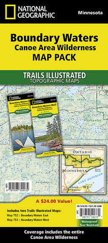
Boundary Waters Canoe Area Wilderness, Map Pack Bundle by National Geographic Maps
With over 1,500 miles of canoe routes, nearly 2,200 designated campsites, and more than 1,000 lakes and streams waiting, the BWCAW draws over 250,000 visitors each year. As part of the Superior National Forest, the BWCAW is managed by the US Forest Service.
Coverage Highlights
It includes both the Boundary Waters Canoe Area East and Boundary Waters Canoe Area West Trails Illustrated maps, providing you coverage of the entire map region. Like all Trails Illustrated maps, the Boundary Waters Map Pack Bundle set is frequently revised and printed on waterproof, tear-resistant material to stand up to all conditions. This detailed topographic recreation map bundle contains carefully researched trails, campsites, forest service roads, and points-of-interests. Includes UTM grids for use with your GPS unit.
Features:
Hiking trails, portages, cross-country, snowmobile and snowshoe trails, trail access locations, campgrounds and tent sites, birding, fishing, kayak, canoeing and power boating opportunities
Ash River, Crane Lake, Kabetogama and Rainy Lake Visitor Centers
Park Attractions: Gull Island Rookery, Grassy Bay Cliffs, Anderson Bay, Kettle Falls, Hoist Bay, Gold Portage.
Map Scale = 1:70,000
contains maps (ML codes):
2034595M
2034596M
- Product Number: 2060065M
- Product Code: TI_BOUNDARY_PK
- Publisher Product ID: TI01020591B
- ISBN: 9781597754132
- Year of Publication: 2013
- Folded Size: 9.45 x 4.33 inches
- Unfolded Size: 37.01 x 24.8 inches
- Map type: Folded Map
- Geographical region: Minnesota


