
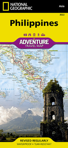
Philippines Adventure Map 3022 by National Geographic Maps
• Waterproof • Tear-Resistant • Travel Map
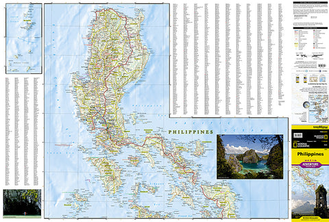
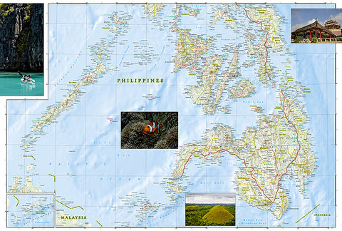
The Philippines, an archipelago of over 7,000 islands in southeast Asia, offer an extraordinary fusion of cultures and rich biodiversity. National Geographics Philippines Adventure Map provides global travelers with the perfect combination of detail and perspective in a highly functional travel tool. Each of the three principal geographic divisions of the country - Luzon, Visayas, and Mindanao - are detailed. The front side of the print map shows Luzon and includes an inset of the Batanes province. The Visayan Islands, Mindanao, and an inset of the province of Tawi-Tawi are shown on the reverse side.
Cities and towns are easy to find with the maps helpful index. Highways and major roads as well as minor and secondary roads are clearly designated and include distance in kilometers so travelers can easily plan their best route. National parks and reserves, World Heritage sites, hot springs, beaches, points of interest, and areas for surfing and diving are indicated so travelers can take advantage of the Philippines many natural attractions and activities. The locations of airports, airfields, railroads, and ferry routes take the guesswork out of travel around the islands.
Every Adventure Map is printed on durable synthetic paper, making them waterproof, tear-resistant and tough - capable of withstanding the rigors of international travel.
Map Scale = 1:1,300,000
- Product Number: 2059767M
- Product Code: NG_AM_PHI
- Publisher Product ID: AD00003022
- ISBN: 9781566956154
- Year of Publication: 2012
- Folded Size: 9.45 x 4.330 inches
- Unfolded Size: 24.8 x 35.83 inches
- Map type: Folded Map
- Geographical region: Philippines


