
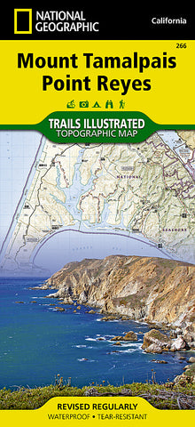


Mount Tamalpais and Point Reyes, Map 266 by National Geographic Maps
This waterproof, tear-resistant, topographic map of Mount Tamalpais and Point Reyes features key areas of interest including Point Reyes National Seashore; Golden Gate National Recreation Area; Tomales Bay, Angel Island, Mount Tamalpais, and Samuel P. Taylor state parks; and Muir Woods National Monument. Also includes a detailed inset of Mount Tamalpais.
With miles of mapped trails including portions of the Bay Area Ridge and California Coastal trails, this map can guide you off the beaten path and back again in some of the most breathtaking scenery in the region. The clearly marked trails include mileages between intersections. The Pacific Coast Highway is noted for those wishing to take in the scenery by car. The map base includes contour lines and elevations for summits, passes, coastal waters, and many lakes. Some of the many recreation features include campgrounds, lighthouses, interpretive trails, wildlife viewing areas, fishing areas, boat launches, and riding stables. Helpful material about the parks, safety tips, and agency contact information is provided as well.
Every Trails Illustrated map is printed on Backcountry Tough waterproof, tear-resistant paper. A full UTM grid is printed on the map to aid with GPS navigation.
Other features found on this map include: Alcatraz Island, Drakes Bay, Duxbury Point, Golden Gate, Golden Gate National Recreation Area, Inverness Ridge, Larkspur, Mill Valley, Point Bonita, Point Reyes, Point Reyes National Seashore, San Anselmo, San Rafael, Strawberry Point, Tomales Bay, and Tomales Point.
- Product Number: 2053330M
- Product Code: TI_MT_TAM
- Publisher Product ID: TI00000266
- ISBN: 9781566955768
- Year of Publication: 2011
- Folded Size: 9.45 x 4.33 inches
- Unfolded Size: 24.8 x 33.07 inches
- Map type: Folded Map
- Geographical region: California


