
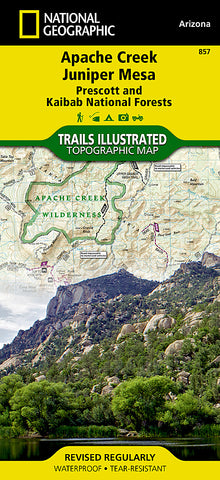
Apache Creek Juniper Mesa, Arizona, Map 857 by National Geographic Maps
• Waterproof • Tear-Resistant • Topographic Map
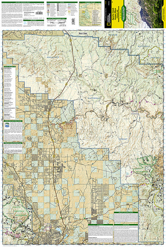
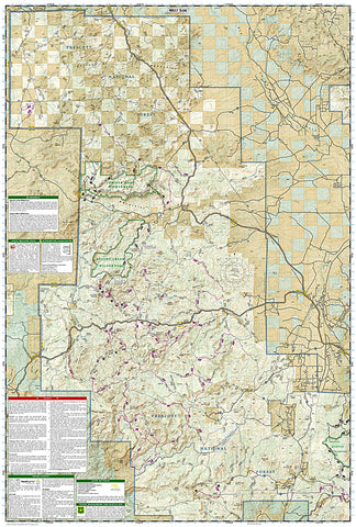
Outdoor enthusiasts adventuring through the northern half of Prescott National Forest will find National Geographics Trails Illustrated map of Apache Creek and Juniper Mesa an essential travel companion. Covering the area in extensive detail, this comprehensive map was expertly researched and created in cooperation with the U.S. Forest Service and others. Some of the recreation hotspots shown are Apache Creek, Juniper Mesa, Woodchute and Granite Mountain Wilderness areas, Upper Verde River State Wildlife Area, Black Hills and Verde Wild and Scenic River.
Explore the area by following mapped trails, clearly labeled for motorized or non-motorized use, including parts of the Great Western Trail, which are highlighted. To aid in your navigation, the map displays contour lines, elevations, labeled peaks, summits and mesas, water features, areas of wooded cover, selected waypoints, numbered Forest Service roads and clearly marked areas of public and private land. Additionally shown is a complete road network including scenic byways, as well as the Chino Valley area. Other recreation features pinpointed are trailheads, campgrounds, ATV areas, motorcycle trails, shooting ranges, boat launches, picnic areas and scenic viewpoints. Background information about the various public lands, a recreation overview, safety tips and essential contact information are also provided.
Every Trails Illustrated map is printed on Backcountry Tough waterproof, tear-resistant paper. A full UTM grid is printed on the map to aid with GPS navigation.
Other features found on this map include: Big Chino Valley, Chino Valley, Granite Mountain, Granite Mountain (AZ) Wilderness, Juniper Mesa Wilderness, Juniper Mountains, Kaibab National Forest, Lonesome Valley, Prescott National Forest, Prescott Valley, Santa Maria Mountains.
- Product Number: 2053326M
- Product Code: TI_APACHE
- Publisher Product ID: TI00000857
- ISBN: 9781566955164
- Year of Publication: 2010
- Folded Size: 9.45 x 4.330 inches
- Unfolded Size: 37.01 x 24.8 inches
- Map type: Folded Map
- Geographical region: Arizona


