
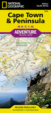
Cape Town and Peninsula, South Africa AdventureMap by National Geographic Maps
• Waterproof • Tear-Resistant • Travel Map
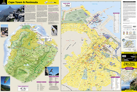
Recreation activities abound in South Africas Cape Peninsula. National Geographics Cape Town and Peninsula Adventure Map is an invaluable tool for exploring this exciting destination. The front side covers both Cape Town and Table Mountain in two separate maps. The street map of Cape Town includes a variety of helpful resources for travelers from lodging, food services, and markets to places of worship, embassies, and information centers. The recreation map of Table Mountain focuses on hiking, equestrian, and mountain bike trails, and paragliding and climbing areas. Parking areas, restaurants, and picnic areas are also clearly indicated.
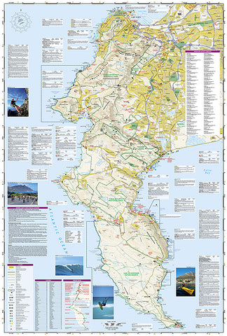
The reverse side details the whole Cape Peninsula and is loaded with helpful information to assist travelers in making the most of the many recreation activities available. These include an adventure activity contacts list as well as safety hints for sea activities. Areas for Hobie sailing, surfskiing, wind surfing, kite surfing, swimming, and surfing are noted. For those who like to recreate on land, paragliding and climbing areas, hiking trails, scenic viewpoints, visitor centers, and many cultural points of interest are indicated. Information on dive sites, nature watching, day trips, sea kayak routes, and more will help you choose the activity thats right for your interest, schedule, and skill level.
Every Adventure Map is printed on durable synthetic paper, making them waterproof, tear-resistant and tough - capable of withstanding the rigors of international travel.
- Product Number: 2050619M
- Product Code: NG_AM_CAPE
- Publisher Product ID: AD00003200
- ISBN: 9781566951654
- Year of Publication: 2004
- Folded Size: 9.45 x 4.330 inches
- Unfolded Size: 36.61 x 24.8 inches
- Map type: Folded Map
- Geographical region: South Africa


