
Washington, Ghost Towns, 6-Map Set, Then and Now by Northwest Distributors
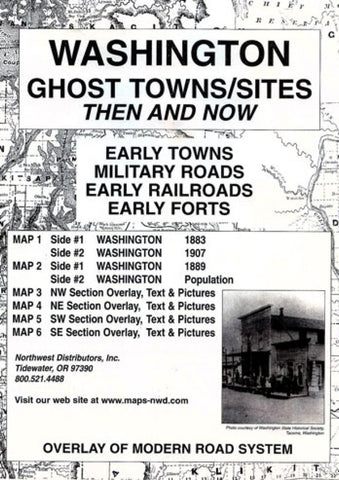
Fascinating series of 6 maps showing historic ghost towns around the state of Washington. Map 1 shows Washington in 1882, and in 1907. Map 2 shows Washington in 1889, and Washington town populations in 1889, 1950, and 1990. Maps 3, 4, 5, and 6 show Washingtons northwest, northeast, southwest, and southest respectively, in the year 1889 with a red overlap on each showing Washington today.
- Product Number: 2048363M
- Product Code: NWD_WA_GHOST
- ISBN: 9780965755863
- Year of Publication: 2001
- Folded Size: 9.45 x 6.3 inches
- Unfolded Size: 16.14 x 21.26 inches
- Map type: Folded Map
- Geographical region: Washington


