
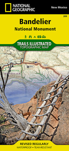
Bandelier National Monument, New Mexico, Map 209 by National Geographic Maps
• Waterproof • Tear-Resistant • Topographic Map
Let National Geographics Trails Illustrated map of Bandelier National Monument guide you on your exploration of this rugged but beautiful landscape of great archeological and historical significance. Created in cooperation with the National Park Service, U.S. Forest Service and others, this expertly researched map is a comprehensive guide to the area for all outdoor enthusiasts, novice and experienced alike. The map includes an abundance of recreation, archeological, geological and historical information along with park regulations, safety tips and essential contact information. Coverage includes the entire national monument, along with Bandelier and Dome Wilderness areas, White Rock Canyon and parts of Santa Fe National Forest and Jemez Mountain Trail Byway.
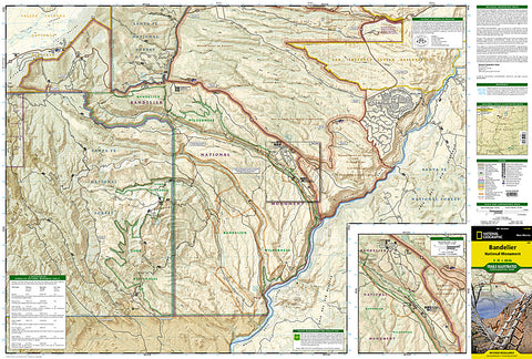
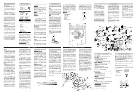
A trail guide lists selected trails leaving the visitor center, with trail descriptions, distances and estimated hiking time. An inset map of the visitor center area provides extra detail of the roads and trails in the area. Alternatively, follow along the road network, including number Forest Service roads, to trailheads in other areas of the monument. To aid in your exploration, the map show contour lines, elevations, labeled peaks and summits, water features, trail distances, selected waypoints and color-coded boundaries between different land management agencies. Other recreation features and amenities pinpointed include camping and picnic areas, restrooms, RV dump stations, parking areas and archeological sites.
Every Trails Illustrated map is printed on Backcountry Tough waterproof, tear-resistant paper. A full UTM grid is printed on the map to aid with GPS navigation.
Other features found on this map include: Bandelier National Monument, Santa Fe National Forest.
Map Scale = 1:35,000
- Product Number: 2036586M
- Product Code: TI_BANDELIER
- Publisher Product ID: TI00000209
- ISBN: 9781566954938
- Year of Publication: 2010
- Folded Size: 9.45 x 4.330 inches
- Unfolded Size: 24.41 x 33.07 inches
- Map type: Folded Map
- Geographical region: New Mexico


