
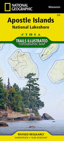
Apostle Islands National Lakeshore, Map 235 by National Geographic Maps
• Waterproof • Tear-Resistant • Topographic Map
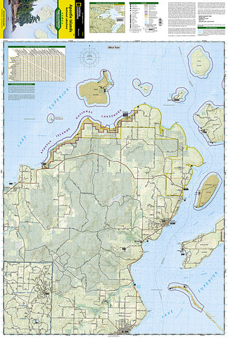
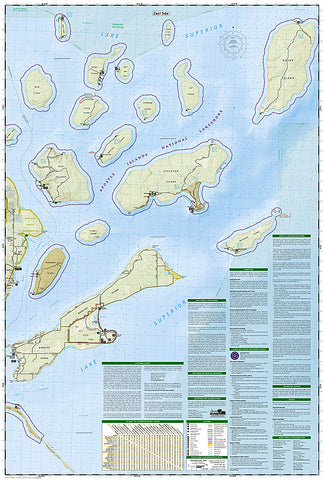
National Geographics Trails Illustrated map of Apostle Islands National Lakeshore was created for outdoor enthusiasts looking to savor the areas unique combination of cultural resources, natural beauty and historical significance. Created in partnership with the National Park Service, U.S. Forest Service, Wisconsin Department of Natural Resources and Bayfield County Land Records Department, this expertly researched map covers the 21 islands and 12 miles of Lake Superior shoreline that comprise the national lakeshore with extensive detail. Also covered by the map are Red Cliffs Indian Reservation, Madeline Island, the northeastern corner of Chequamegon-Nicolet National Forest and the Bayfield Peninsula.
The maps many recreations points of interest will aid your exploration of the islands. Boat and kayak launch areas and marinas on the mainland are all marked along with the docks on the various islands. Lake Superior and the many bays all appear with bathymetric contour lines and soundings. Hiking trails with topographic contour lines and elevations will assist in your exploration on land. Additional recreation features include areas for snowmobiles, downhill and cross-country skiing, picnics and camping. The areas lighthouses and sea caves are all pinpointed. To help plan your visit, the map provides an island-to-island mileage chart, background information about the national shoreline and Gaylord Nelson Wilderness, camping regulations, safety tips and essential contact information.
Every Trails Illustrated map is printed on Backcountry Tough waterproof, tear-resistant paper. A full UTM grid is printed on the map to aid with GPS navigation.
Other features found on this map include: Apostle Islands, Chequamegon National Forest, Chequamegon Point, Madeline Island, Michigan Island, Oak Island, Outer Island, Sand Island, Stockton Island.
- Product Number: 2034660M
- Product Code: TI_APOSTLE
- Publisher Product ID: TI00000235
- ISBN: 9781566953665
- Year of Publication: 2007
- Folded Size: 9.45 x 4.33 inches
- Unfolded Size: 37.01 x 24.8 inches
- Map type: Folded Map
- Geographical region: Wisconsin


