
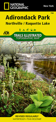
Adirondack Park, Northville and Raquette Lake, Map 744 by National Geographic Maps
• Waterproof • Tear-Resistant • Topographic Map
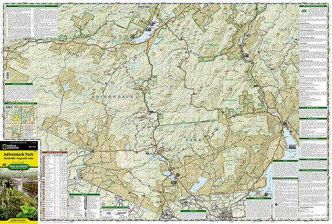
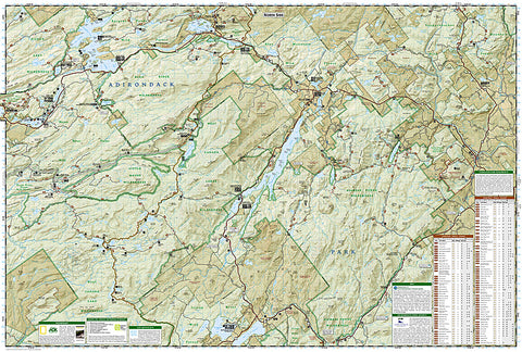
National Geographics Trails Illustrated map of Adirondack Park Northville/Raquette Lake is a two-sided, waterproof, topographic trail map designed to meet the needs of outdoor enthusiasts with unmatched durability and detail. This map was created in cooperation with the Adirondack Mountain Club and is loaded with valuable recreation information for boating, hiking, fishing, sailing, cycling, ice fishing, skiing, and snowmobiling. Trails and major roads are clearly distinguished, from the picturesque foothills to the northern peaks and around lakes of all sizes. Campgrounds, climbing areas, marinas, and museums are labeled and easy to find and boundaries for park lands, wilderness, primitive, forest, and protected areas are clearly marked. Discover the Adirondacks wild, rugged and beautiful terrain, with detailed elevation contours, shaded relief, vegetation, and water features.
Coverage includes Siamese Ponds, Silver Lake, West Canada Lake, and Blue Ridge Wilderness Areas; Wilcox Lake, Shaker Mountain, Ferris Lake, Moose River Plains, Sargent Ponds, Blue Mountain, and Vanderwhacker Mountain Wild Forests; and the Northville-Lake Placid Trail from Northville to Blue Mountain Wild Forest. Also includes Mayfield, Speculator, Indian Lake, and North Creek.
The Adirondack Park Northville/Raquette Lake map is designed and printed in the United States on durable synthetic paper, making it waterproof, tear-resistant, and trail tough - made to head outside and go anywhere you do.
- Product Number: 2034613M
- Product Code: TI_NY_744
- Publisher Product ID: TI00000744
- ISBN: 9781566953108
- Year of Publication: 2013
- Folded Size: 9.45 x 4.33 inches
- Unfolded Size: 24.8 x 37.01 inches
- Map type: Folded Map
- Geographical region: New York


