
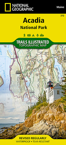
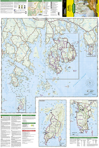
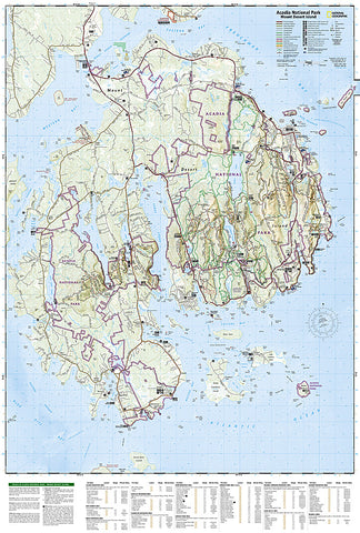
Acadia National Park, Maine, Map 212 by National Geographic Maps
Waterproof, tear-resistant, topographic map covering all of Acadia National Park on Mount Desert Island, Maine. Features Mount Desert Island, Sestern Mountain, Norwood Ridge, Freeman Ridge, Isle au Haut, Marshall Island, Swans Island, Western Bay, Mount Desert Narrows, Frenchman Bay, Eastern Way, Eastern Passage, Long Pond, Seal Cove Pond, Echo Lake, Somes Sound, Upper and Lower Hadlock Pond, Jordan Pond, and Eagle Lake. GPS compatible with full ATM grid.
Each map is based on exact reproductions of USGS topographic map information, updated, customized, and enhanced to meet the unique features of each area. Printed on waterproof, tear-resistant material with a plastic coating that offers supreme durability with a new color palette and stunning shaded relief. Revised edition reflects road closings, new trails, and campground relocation.
Includes detailed trail information, points of interest, trailheads, picnic areas, facilities, and more. Includes valuable wilderness tips and Leave No Trace guidelines.
- Product Number: 2034593M
- Product Code: TI_ACADIA
- Publisher Product ID: TI00000212
- ISBN: 9781566953528
- Year of Publication: 2002
- Folded Size: 9.45 x 4.330 inches
- Unfolded Size: 32.68 x 24.80 inches
- Map type: Folded Map
- Geographical region: Maine


