
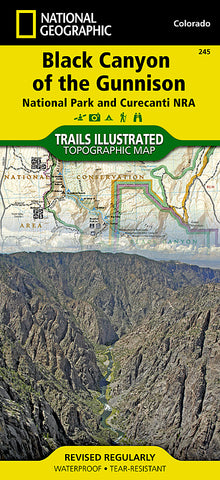
Black Canyon of the Gunnison National Park, Colorado, Map 245 by National Geographic Maps
Click to Zoom (high resolution)
• Waterproof • Tear-Resistant • Topographic Map
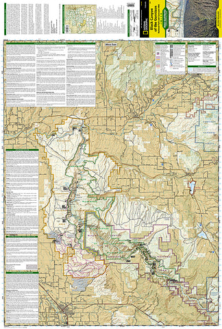
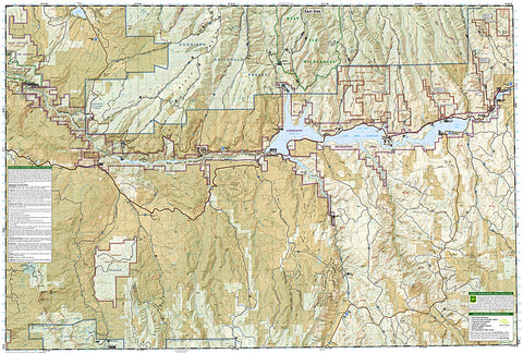
This two-sided map includes Black Canyon National Park in its entirety, and Gunnison Gorge Wilderness, and portions of Gunnison Gorge National Conservation Area. South Rim trails include Rim Rock Trail, Uplands Trail, Oak Flat Loop, Cedar Point Trail, and Warner Point Trail. The North Rim trails include Chasm View Trail, North Vista Trail, and Deadhorse Trail. Campgounds, fishing spots, overlooks, view points, visitor centers, and cultural sites thoughout the park are shown, as well as rapids and ratings along the Gunnison River. Includes UTM grids for use with your GPS unit.
Map Scale = 1:63,360
- Product Number: 2034556M
- Product Code: TI_BLACK_CAN
- Publisher Product ID: TI00000245
- ISBN: 9781566953689
- Year of Publication: 2009
- Folded Size: 9.45 x 4.330 inches
- Unfolded Size: 24.8 x 37.01 inches
- Map type: Folded Map
- Geographical region: Colorado


