
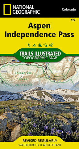
Aspen, Independence Pass, Colorado by National Geographic Maps
Click to Zoom (high resolution)
• Waterproof • Tear-Resistant • Topographic Map
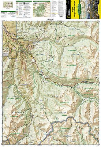
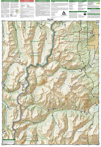
Coverage includes White River, San Isabel and Gunnison national forests. Maroon Bells Snowmass, Hunter Fryingpan, Mt. Massive, Collegiate Peaks and Spruce Creek wilderness areas. Aspen and Twin lakes. Roaring Fork River, Lake and Lincoln creeks. 14ers: Mt. Elbert, Mt. Massive, Castle and La Plata peaks. Willis, Fryingpan and Evergreen lakes. Taylor, Midway, and Independence passes. Ski Areas: Aspen and Buttermilk. 10th Mountain Huts: Tagert Hut, Wilson Hut, Barnard Hut, Markely Hut, McNamara Hut. Includes UTM grids for use with your GPS unit and Colorado Game Management Unit (GMU) boundaries.
- Product Number: 2034555M
- Product Code: TI_CO_127
- Publisher Product ID: TI00000127
- ISBN: 9781566953580
- Year of Publication: 2013
- Folded Size: 7.48 x 3.940 inches
- Unfolded Size: 26.77 x 20.870 inches
- Map type: Folded Map
- Geographical region: Colorado


