
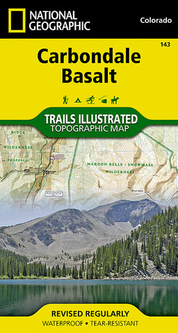
Carbondale Basalt, Colorado, Map 143 by National Geographic Maps
• Waterproof • Tear-Resistant • Topographic Map
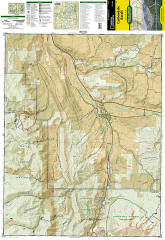
Colorados Roaring Fork Valley is a popular destination for year-round outdoor recreation from Gold Medal trout fishing and mountain biking to skiing and snowmobiling. National Geographics Trails Illustrated map of Carbondale and Basalt delivers detail and valuable information to assist you in making the most of your time in this scenic mountain valley. Expertly researched and created in partnership with local land management agencies, this map features key points of interest including Roaring Fork, Fryingpan and Crystal rivers; Basalt Mountain; Sunlight Ski Area; Red Table Mountain; Basalt State Wildlife Area; Mount Sopris; and the towns of Carbondale and Basalt.
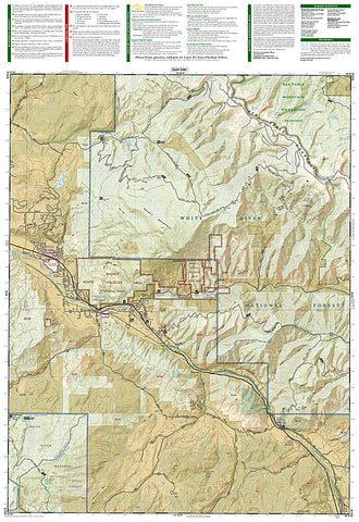
With miles of mapped trails highlighted according to use, this map can guide you off the beaten path and back again in some of the most breathtaking scenery in the region. Cyclists will appreciate the detail paid to the many hard surface and mountain bike trails in the region. West Elk Loop Scenic Byway is noted for those wishing to take in the scenery by car. The map base includes contour lines and elevations for summits, passes and some lakes. Many recreation features are noted as well including campgrounds, trailheads, picnic areas, wildlife viewing areas, shooting ranges, fishing access, and ski areas.
Every Trails Illustrated map is printed on Backcountry Tough waterproof, tear-resistant paper. A full UTM grid is printed on the map to aid with GPS navigation.
Other features found on this map include: Crystal River, Maroon Bells-Snowmass Wilderness, White River National Forest.
- Product Number: 2034554M
- Product Code: TI_CARBONDALE
- Publisher Product ID: TI00000143
- ISBN: 9781566953993
- Year of Publication: 2005
- Folded Size: 7.48 x 3.94 inches
- Unfolded Size: 26.38 x 20.87 inches
- Map type: Folded Map
- Geographical region: Colorado


