
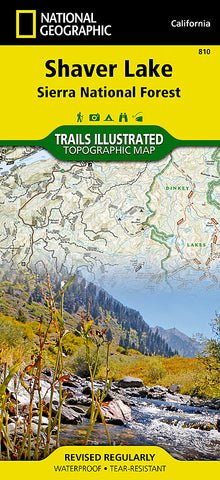


Shaver Lake and Sierra National Forest, Map 810 by National Geographic Maps
Waterproof, tear-resistant, topographic map of Shaver Lake.
Trails Illustrated Shaver Lake / Sierra National Forest is the second of five exciting new maps for the California Sierra Nevadas that will combine to form seamless coverage of the high-use National Forest areas between Sequoia / Kings Canyon National Parks and Lake Tahoe. This region contains some of the most visited backcountry in the United States, popular with hikers, mountain bikers, anglers, hunters, and winter sports enthusiasts.
Like all Trails Illustrated maps, Shaver Lake / Sierra National Forest was developed in collaboration with local agencies and experts, in this case the Three Forests Interpretive Association which supports Sierra, Stanislaus, and Sequoia National Forests.
Shaver Lake contains coverage for Sierra National Forest, Kaiser Wilderness, Dinkey Lakes Wilderness, portions of the John Muir and Monarch Wilderness, Mariposa Grove of Giant Sequoias within Yosemite NP, Nelder Grove Historic Park, Millerton Lake State Recreation Area, Redinger Lake, Bass Lake, Huntington Lake, Courtright Reservoir, Wishon Reservoir, and Shaver Lake.
- Product Number: 2034547M
- Product Code: TI_SHAVER
- Publisher Product ID: TI00000810
- ISBN: 9781566952422
- Year of Publication: 2008
- Folded Size: 9.45 x 4.33 inches
- Unfolded Size: 37.01 x 24.8 inches
- Map type: Folded Map
- Geographical region: California


