
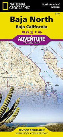
Baja California, North Adventure Map 3103 by National Geographic Maps
• Waterproof • Tear-Resistant • Travel Map
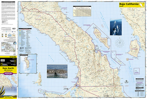
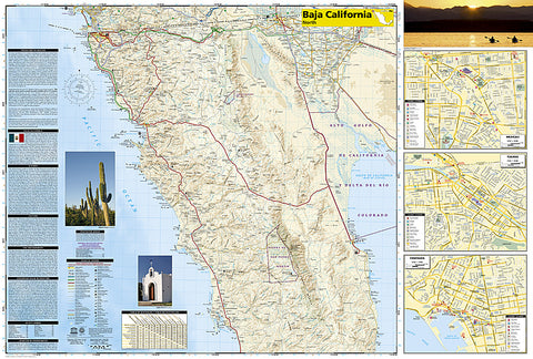
Located in Northwestern Mexico, the Baja California Peninsula is a popular travel destination for its abundant recreation and conservation opportunities. National Geographics Baja North Adventure Map covers with extensive detail the state of Baja California and part of the UNESCO World Heritage Site, Islands and Protected Areas of the Gulf of California. The northern side of the map covers the US/Mexico border from Tijuana to Mexicali, including border crossings, as well as Ensenada. Inset maps give extensive detail to these three towns. The southern side shows Valle de los Cirios, Bahia de los Angeles and the World Heritage listed Rock Paintings of the Sierra de San Francisco and Whale Sanctuary of El Vizcaino.
Cultural, historical, recreational and ecological points of interest, a road network and topographic features are all combined on this easy to use and expertly researched map. With such specialized content, this map is the perfect compliment to any guidebook. Pinpointed are missions, ruins, museums, lighthouses, scenic viewpoints, wildlife viewing spots, beaches and areas for surfing, diving, fishing, kayaking, sailing, windsurfing, snorkeling and whale watching. The detailed road network includes not only major highways and toll roads but also gravel and dirt roads, to help you get off the beaten path. Moreover, a table of distances is provided as are ferry routes, railroads and an index of protected areas and select towns.
Every Adventure Map is printed on durable synthetic paper, making them waterproof, tear-resistant and tough - capable of withstanding the rigors of international travel.
Map Scale = 1:25,000 & 1:450,000
- Product Number: 2034479M
- Product Code: NG_AM_BAJA_N
- Publisher Product ID: AD00003103
- ISBN: 9781566952439
- Year of Publication: 2008
- Folded Size: 9.45 x 4.33 inches
- Unfolded Size: 24.8 x 32.68 inches
- Map type: Folded Map
- Geographical region: Mexico


