
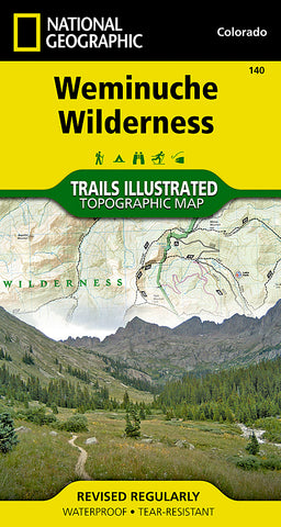


Weminuche Wilderness, Map 140 by National Geographic Maps
Click to Zoom (high resolution)
Waterproof, tear-resistant, topographic map of Weminuche Wilderness, CO. Coverage includes San Juan and Rio Grande national forests; Weminuche Wilderness; Williams Creek; Big Meadows and Rio Grand reservoirs; Chicago Basin, Emerald, and Electra lakes; Wagon Wheel Gap, Wolf Creek, and Rockwood. 14ers: Sunlight Peak, Windom Peak, Mt Eolus; Piedra, Squaw and Molas passes; San Juan Mountains; San Juan, Rio Grande and Los Pinos rivers. Ski Area: Wolf Creek. Includes portions of the Continental Divide Trail and the Colorado Trail. Includes UTM grids for use with your GPS unit.
- Product Number: 2029323M
- Product Code: TI_CO_140
- Publisher Product ID: TI00000140
- ISBN: 9781566952910
- Year of Publication: 2011
- Folded Size: 7.48 x 3.94 inches
- Unfolded Size: 24.8 x 36.61 inches
- Map type: Folded Map
- Geographical region: Colorado


