
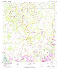
~ Citrus Park FL topo map, 1:24000 scale, 7.5 X 7.5 Minute, Historical, 1956, updated 1970
Citrus Park, Florida, USGS topographic map dated 1956.
Includes geographic coordinates (latitude and longitude). This topographic map is suitable for hiking, camping, and exploring, or framing it as a wall map.
Printed on-demand using high resolution imagery, on heavy weight and acid free paper, or alternatively on a variety of synthetic materials.
Topos available on paper, Waterproof, Poly, or Tyvek. Usually shipping rolled, unless combined with other folded maps in one order.
- Product Number: USGS-5622980
- Free digital map download (high-resolution, GeoPDF): Citrus Park, Florida (file size: 10 MB)
- Map Size: please refer to the dimensions of the GeoPDF map above
- Weight (paper map): ca. 55 grams
- Map Type: POD USGS Topographic Map
- Map Series: HTMC
- Map Verison: Historical
- Cell ID: 8828
- Scan ID: 345522
- Imprint Year: 1970
- Woodland Tint: Yes
- Photo Revision Year: 1969
- Aerial Photo Year: 1969
- Survey Year: 1956
- Datum: NAD27
- Map Projection: Polyconic
- Map published by United States Geological Survey
- Map Language: English
- Scanner Resolution: 600 dpi
- Map Cell Name: Citrus Park
- Grid size: 7.5 X 7.5 Minute
- Date on map: 1956
- Map Scale: 1:24000
- Geographical region: Florida, United States
Neighboring Maps:
All neighboring USGS topo maps are available for sale online at a variety of scales.
Spatial coverage:
Topo map Citrus Park, Florida, covers the geographical area associated the following places:
- Carrollwood West - Carrollwood Creek - Waterfront Cove - Essex Downs - Pebblebrook - Saint Andrews Square - Farmington - Woodbriar West - Logan Place - Lynn Lake - Hidden Valley - Mill Pond Village - Waterstone - Greenbrook Village - Jasmine Pond - Lake Josephine Estates - Citrus Pointe - Andover - Koostra - Waterchase - Monaco Gardens - Lake Maurine Estates - Woodbridge at Rocky Creek - Country Place - Turner Trace - Arthur Estates - Levinson - Highland Park - Whisper Sound - Fairway Village - The Landings of Tampa - Estates of Rock Lake - Glen Ellen Village - Galleria - Warren Estates - Woodham Farms - Martha Ann Trailer Village - Arlington - Horseshoe Estates - Mandolin - Westchase - White Trout Lake Shores - Belle Glen - Hollyglen Village - Fawn Ridge Village - Timberlane - Rainbow Terrace - Ehrlich Gardenlands - Carrollwood Reserve - Andover Village - Crestridge - Pinehurst Villas - Rosemount Village - Hudson Terrace - Carrollwood Crossing - Hammock Woods - Armistead Manor - Sheldon Chase - Villager Place - Lake View Park - Himes Avenue Estates - Keystone Shores Estates - Oakwood Villa - Lane Farms - Sunray Estates - Solana Bay - Rocky Creek - Floraland Acres - Patterson Road - Arlington Oaks - Carrollwood Key - Mandarin Lakes - Town 'n' Country - Oakmeadows West - West Park - Bent Tree Place - Triple Lake Shores - Carrollwood Pines - Cypress Glen - Woodbridge Park - Northton Groves - Huntington of Carrollwood - Triple Lakes - Arbor Oaks - Whispering Oaks - Brookshire - Hilltop Acres - O'Ryans Point on Half Moon Lake - Harr Estates - Ocean Harbor - Eastbrook - Enclave at Citrus Park - Citrus Acres - Northwest Park - Bellamy - Citrus Park Crossing - Carrollwood Meadows - Cypress Hollow - Rocky Pond - Carrollwood Village
- Map Area ID: AREA28.12528-82.625-82.5
- Northwest corner Lat/Long code: USGSNW28.125-82.625
- Northeast corner Lat/Long code: USGSNE28.125-82.5
- Southwest corner Lat/Long code: USGSSW28-82.625
- Southeast corner Lat/Long code: USGSSE28-82.5
- Northern map edge Latitude: 28.125
- Southern map edge Latitude: 28
- Western map edge Longitude: -82.625
- Eastern map edge Longitude: -82.5


