
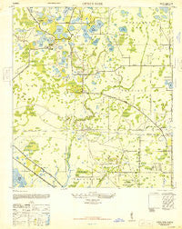
~ Citrus Park FL topo map, 1:24000 scale, 7.5 X 7.5 Minute, Historical, 1947
Citrus Park, Florida, USGS topographic map dated 1947.
Includes geographic coordinates (latitude and longitude). This topographic map is suitable for hiking, camping, and exploring, or framing it as a wall map.
Printed on-demand using high resolution imagery, on heavy weight and acid free paper, or alternatively on a variety of synthetic materials.
Topos available on paper, Waterproof, Poly, or Tyvek. Usually shipping rolled, unless combined with other folded maps in one order.
- Product Number: USGS-5622968
- Free digital map download (high-resolution, GeoPDF): Citrus Park, Florida (file size: 11 MB)
- Map Size: please refer to the dimensions of the GeoPDF map above
- Weight (paper map): ca. 55 grams
- Map Type: POD USGS Topographic Map
- Map Series: HTMC
- Map Verison: Historical
- Cell ID: 8828
- Scan ID: 345519
- Woodland Tint: Yes
- Aerial Photo Year: 1942
- Datum: NAD27
- Map Projection: Transverse Mercator
- Map published by United States Army Corps of Engineers
- Map published by United States Army
- Map Language: English
- Scanner Resolution: 600 dpi
- Map Cell Name: Citrus Park
- Grid size: 7.5 X 7.5 Minute
- Date on map: 1947
- Map Scale: 1:24000
- Geographical region: Florida, United States
Neighboring Maps:
All neighboring USGS topo maps are available for sale online at a variety of scales.
Spatial coverage:
Topo map Citrus Park, Florida, covers the geographical area associated the following places:
- O'Ryans Point on Half Moon Lake - Mill Pond Village - Plouff - Hidden Oaks - Ehrlich Gardenlands - Turtle Creek - Dolce Vita - Keystone Meadow I - Cypress Glen - Eastbrook - Cambridge Villas - The Landings of Tampa - Mullis City - Bayport West - Lake Julia - Tree Tops North - White Trout Lake Shores - Cedarwood Village - Country Club Village at Carrollwood - West Bay - Frenchs - Ansley Park - Essex Downs - Andover - Northwest Park - Westchase - Cumberland Estates - Indian Oaks - Town 'n' Country - Arthur Estates - Timberlane - Eagle Creek - Kirby Creek - Carrollwood Crossing - Hunters Glen - Carrollwood South - Chadbourne Village - Reserve on Rock Lake - Rocky Pond - Eaglebrook - Paddock Trail - Rocky Ford - Shaw Place - Jane Terrace - North End Terrace - Northdale - Beacon Meadows - Sugarwood Grove - Lake Josephine Estates - The Trails at Van Dyke Farms - Sunray Gardens - Copperfield - Lake View Park - Four Score Manor - Glen Ellen Village - Carrillon Estates - Cypress Willows - Heatherwood Village - Hidden Lake - Foxs Corner - Pennington Village - Arlington Oaks - Pebblebrook - Catherine Park - Rose Harbor - Lake Crest Manor - Rocky Creek - Lake Maurine - Bellefield Village - Enclave at Citrus Park - Hudson Terrace - Green Grass Acres - Southern Comfort Homes - Carrollwood Oaks - Pat Acres - Belle Glen Addition - Country Place West - Half Moon Lake Estates - Keystone Shores Estates - Towne Place - Quail Ridge North - Springwood Village - Ventana - Arlington - Lowell Village - Koostra - Traditions at Woodmont - Brentwood - Carroll Oaks - East Village - The Village South - The Cloister - Woodmont - Berkford Place - Harr Estates - Cypress Tree - Pretty Lake Estates - Oak View Terrace - Lynn Lake - West Park Estates
- Map Area ID: AREA28.12528-82.625-82.5
- Northwest corner Lat/Long code: USGSNW28.125-82.625
- Northeast corner Lat/Long code: USGSNE28.125-82.5
- Southwest corner Lat/Long code: USGSSW28-82.625
- Southeast corner Lat/Long code: USGSSE28-82.5
- Northern map edge Latitude: 28.125
- Southern map edge Latitude: 28
- Western map edge Longitude: -82.625
- Eastern map edge Longitude: -82.5


