
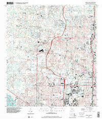
~ Citrus Park FL topo map, 1:24000 scale, 7.5 X 7.5 Minute, Historical, 1998, updated 2001
Citrus Park, Florida, USGS topographic map dated 1998.
Includes geographic coordinates (latitude and longitude). This topographic map is suitable for hiking, camping, and exploring, or framing it as a wall map.
Printed on-demand using high resolution imagery, on heavy weight and acid free paper, or alternatively on a variety of synthetic materials.
Topos available on paper, Waterproof, Poly, or Tyvek. Usually shipping rolled, unless combined with other folded maps in one order.
- Product Number: USGS-5622964
- Free digital map download (high-resolution, GeoPDF): Citrus Park, Florida (file size: 13 MB)
- Map Size: please refer to the dimensions of the GeoPDF map above
- Weight (paper map): ca. 55 grams
- Map Type: POD USGS Topographic Map
- Map Series: HTMC
- Map Verison: Historical
- Cell ID: 8828
- Scan ID: 345518
- Imprint Year: 2001
- Woodland Tint: Yes
- Aerial Photo Year: 1998
- Survey Year: 1956
- Datum: NAD83
- Map Projection: Universal Transverse Mercator
- Map published by United States Geological Survey
- Map Language: English
- Scanner Resolution: 600 dpi
- Map Cell Name: Citrus Park
- Grid size: 7.5 X 7.5 Minute
- Date on map: 1998
- Map Scale: 1:24000
- Geographical region: Florida, United States
Neighboring Maps:
All neighboring USGS topo maps are available for sale online at a variety of scales.
Spatial coverage:
Topo map Citrus Park, Florida, covers the geographical area associated the following places:
- Culbreath Oaks - Westchase - Southfork at Van Dyke Farms - Hollyglen Village - Fairway Village - Turtle Crossing - Carrollwood Reserve - Monaco Gardens - Lake Maurine - Spivey - Woodbridge Park - Whispering Oaks - Brentwood - Cypress Hollow - Oakwood Villa - Himes Avenue Estates - West Waters Village - Lake Josephine Estates - Half Moon Lake Estates - Four Score Manor - Indian Lakes - Durango - Oak View Terrace - Hilltop Acres - Burnbrook - O'Ryans Point on Half Moon Lake - The Landings of Tampa - Patterson Road - Community Estates - Fountain Park - Woodroffe Estates - White Trout Lake Shores - Cedarwood Village - Arlington Oaks - North Village - Andover Village - Tree Tops North - Wood Lake - Creekside - Carrillon Estates - Bent Tree Place - Timberlane - Westridge Village - Country Run - Rocky Pond - Le Clare Shores - Armistead Manor - Carrollwood Estates - Ehrlich Gardenlands - Keystone Shores Estates - Lakeside Grove Estates - Woodham Farms - Miralago Estates - Bellefield Village - Rock Lake - Sunray Gardens - Pennington Village - Fairfield Village - Villager Place - Country Club Village at Carrollwood - Town of Citrus Park - J-R Manor - Mandarin Lakes - Villas of Northdale - Kirby Creek - Brookgreen Village - Woodbriar West - Stonegate - Quail Ridge North - Country Place - Paddock Trail - Reserve at Woodmont - Keystone Acres - Village Wood - Westmont Oaks - Koostra - East Village - The Village West - Lake View Park - Mullis City - Oldsmar Farm - Sugarwood Grove - Cypress Willows - Glen Ellen Village - Arbor Lakes - West Park - Logan Gate Village - Fawn Ridge Village - Idle Forest - Cedar Creek at Country Run - Arlington - Woods of Eden Rock - Woodbridge at Rocky Creek - Cypress Tree - Levinson - West Park Estates - Shaw Place - Yent - Northwest Park - Plouff
- Map Area ID: AREA28.12528-82.625-82.5
- Northwest corner Lat/Long code: USGSNW28.125-82.625
- Northeast corner Lat/Long code: USGSNE28.125-82.5
- Southwest corner Lat/Long code: USGSSW28-82.625
- Southeast corner Lat/Long code: USGSSE28-82.5
- Northern map edge Latitude: 28.125
- Southern map edge Latitude: 28
- Western map edge Longitude: -82.625
- Eastern map edge Longitude: -82.5


