
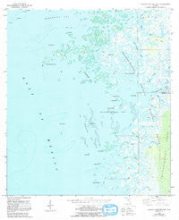
~ Chassahowitzka Bay FL topo map, 1:24000 scale, 7.5 X 7.5 Minute, Historical, 1954, updated 1992
Chassahowitzka Bay, Florida, USGS topographic map dated 1954.
Includes geographic coordinates (latitude and longitude). This topographic map is suitable for hiking, camping, and exploring, or framing it as a wall map.
Printed on-demand using high resolution imagery, on heavy weight and acid free paper, or alternatively on a variety of synthetic materials.
Topos available on paper, Waterproof, Poly, or Tyvek. Usually shipping rolled, unless combined with other folded maps in one order.
- Product Number: USGS-5622812
- Free digital map download (high-resolution, GeoPDF): Chassahowitzka Bay, Florida (file size: 15 MB)
- Map Size: please refer to the dimensions of the GeoPDF map above
- Weight (paper map): ca. 55 grams
- Map Type: POD USGS Topographic Map
- Map Series: HTMC
- Map Verison: Historical
- Cell ID: 8259
- Scan ID: 345472
- Imprint Year: 1992
- Woodland Tint: Yes
- Aerial Photo Year: 1951
- Edit Year: 1992
- Datum: NAD27
- Map Projection: Universal Transverse Mercator
- Map published by United States Geological Survey
- Map Language: English
- Scanner Resolution: 600 dpi
- Map Cell Name: Chassahowitzka Bay
- Grid size: 7.5 X 7.5 Minute
- Date on map: 1954
- Map Scale: 1:24000
- Geographical region: Florida, United States
Neighboring Maps:
All neighboring USGS topo maps are available for sale online at a variety of scales.
Spatial coverage:
Topo map Chassahowitzka Bay, Florida, covers the geographical area associated the following places:
- Colvalia Key - Blue Bay - Black Rock - Saddle Key - Haulover Creek - Sheephead Key - South Blind Creek - Chassahowitzka Wilderness - Chassahowitzka Reefs - Bird Island - Fish Creek - Chassahowitzka Bay - Seven Cabbage Cutoff - Chub Creek - Chassahowitzka Point - Porpoise Bay - Blind Creek - Seven Cabbage Island - Homosassa Bay - Embassy Plaza - Northwest Keys - Long Point - Pumpkin Creek - Lone Cabbage Creek - Drum Key - Twin Creek - Long Island - Mud Creek - Custom Commerce Center - Chassahowitzka River - Rose Creek - Slate Island - Buckhorn Key - Pompano Key - Johns Island - Gator Creek - Chassahowitzka National Wildlife Refuge - Oyster Creek - Sugar Spot - May Creek - Crawl Key - South Point - North Blind Creek - Camp Creek
- Map Area ID: AREA28.7528.625-82.75-82.625
- Northwest corner Lat/Long code: USGSNW28.75-82.75
- Northeast corner Lat/Long code: USGSNE28.75-82.625
- Southwest corner Lat/Long code: USGSSW28.625-82.75
- Southeast corner Lat/Long code: USGSSE28.625-82.625
- Northern map edge Latitude: 28.75
- Southern map edge Latitude: 28.625
- Western map edge Longitude: -82.75
- Eastern map edge Longitude: -82.625


