
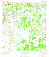
~ Brandon FL topo map, 1:24000 scale, 7.5 X 7.5 Minute, Historical, 1956, updated 1965
Brandon, Florida, USGS topographic map dated 1956.
Includes geographic coordinates (latitude and longitude). This topographic map is suitable for hiking, camping, and exploring, or framing it as a wall map.
Printed on-demand using high resolution imagery, on heavy weight and acid free paper, or alternatively on a variety of synthetic materials.
Topos available on paper, Waterproof, Poly, or Tyvek. Usually shipping rolled, unless combined with other folded maps in one order.
- Product Number: USGS-5622540
- Free digital map download (high-resolution, GeoPDF): Brandon, Florida (file size: 10 MB)
- Map Size: please refer to the dimensions of the GeoPDF map above
- Weight (paper map): ca. 55 grams
- Map Type: POD USGS Topographic Map
- Map Series: HTMC
- Map Verison: Historical
- Cell ID: 5263
- Scan ID: 345296
- Imprint Year: 1965
- Woodland Tint: Yes
- Aerial Photo Year: 1955
- Survey Year: 1956
- Datum: NAD27
- Map Projection: Polyconic
- Map published by United States Geological Survey
- Map Language: English
- Scanner Resolution: 600 dpi
- Map Cell Name: Brandon
- Grid size: 7.5 X 7.5 Minute
- Date on map: 1956
- Map Scale: 1:24000
- Geographical region: Florida, United States
Neighboring Maps:
All neighboring USGS topo maps are available for sale online at a variety of scales.
Spatial coverage:
Topo map Brandon, Florida, covers the geographical area associated the following places:
- Goins Terrace - Timber Creek - Ponderosa - Campos Valrico - Murray Acres - Las Brisas - The Villas at Bloomingdale - Royal Crest Estates - Green Meadow Estates - Raven Oaks - Brandon Village - Abbey Trace - Garden Oaks - Oakwood Ravine - Eastside Mobile Villa - Kingwood Park - Greenewood - Bloomingdale Oaks - Oakridge Manor - Legacy Park - Winston Manor - Hunters Cove - Pats - Sunrise Manor - Timber Knoll - Carrollton - The Groves North - Chestnut Forest - Lakewood Ridge Estates South - Pine Lawn Terrace - Fishers Farms - Brandon View Estates - Hickory Woods - Kingsway Oaks - Belle Timbre - Big Pines - Sunway - Lavity - Brandon Country Estates - Van Sant - Oakmont Park - Avalon Terrace - Ravenwood - Eden Wood - Branda Vista - The Estates at Bloomingdale - Presidential Manor - Brandon Lakewood Estates - Wheeler Groves - Hillcrest Mobile Estates - Taylor Bay Estates - Brandon Estates - Sheffield East - Fernwood Terrace - Wheeler Crossings - Anselmi Acres - Cambridge Place - Long Pond - Waterford - Buffalo Avenue Farms - Eastlyn - Bloomingdale Village - Nita Estates - Brower - Southern Oaks Grove - Brandontree - Cashin Oaks - Valrico Oaks - Lynnhaven - Valrico Village - Stratford - Amber Place - Colonial Oaks - Eleven Mile Hill - Estates at Limona Woods - Frye - Boulevard Villas - Bryan Manor - Marphil Manor - Lakewood Ridge Estates North - Kingsway Heights - Wheeler Oaks - Kingstowne Place - Breezy Meadows - Perrywood - Sylvia Manor - Glen Oaks South - Valrico Woodland - East Gate Mobile Estates - Phillips Estates - Little Oak Estates - Tangelo - Eureka Homes - Valrico Lake - Seffner - Brandon Groves North - Villages of Lake Saint Charles - Seffner Ridge Estates - Pavilion Phase 3 - Burlington Heights
- Map Area ID: AREA2827.875-82.375-82.25
- Northwest corner Lat/Long code: USGSNW28-82.375
- Northeast corner Lat/Long code: USGSNE28-82.25
- Southwest corner Lat/Long code: USGSSW27.875-82.375
- Southeast corner Lat/Long code: USGSSE27.875-82.25
- Northern map edge Latitude: 28
- Southern map edge Latitude: 27.875
- Western map edge Longitude: -82.375
- Eastern map edge Longitude: -82.25


