
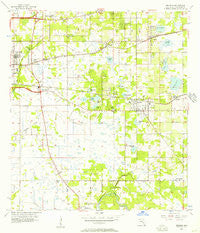
~ Brandon FL topo map, 1:24000 scale, 7.5 X 7.5 Minute, Historical, 1956, updated 1957
Brandon, Florida, USGS topographic map dated 1956.
Includes geographic coordinates (latitude and longitude). This topographic map is suitable for hiking, camping, and exploring, or framing it as a wall map.
Printed on-demand using high resolution imagery, on heavy weight and acid free paper, or alternatively on a variety of synthetic materials.
Topos available on paper, Waterproof, Poly, or Tyvek. Usually shipping rolled, unless combined with other folded maps in one order.
- Product Number: USGS-5622538
- Free digital map download (high-resolution, GeoPDF): Brandon, Florida (file size: 9 MB)
- Map Size: please refer to the dimensions of the GeoPDF map above
- Weight (paper map): ca. 55 grams
- Map Type: POD USGS Topographic Map
- Map Series: HTMC
- Map Verison: Historical
- Cell ID: 5263
- Scan ID: 345295
- Imprint Year: 1957
- Woodland Tint: Yes
- Aerial Photo Year: 1955
- Survey Year: 1956
- Datum: NAD27
- Map Projection: Polyconic
- Map published by United States Geological Survey
- Map Language: English
- Scanner Resolution: 600 dpi
- Map Cell Name: Brandon
- Grid size: 7.5 X 7.5 Minute
- Date on map: 1956
- Map Scale: 1:24000
- Geographical region: Florida, United States
Neighboring Maps:
All neighboring USGS topo maps are available for sale online at a variety of scales.
Spatial coverage:
Topo map Brandon, Florida, covers the geographical area associated the following places:
- Brandon Meadows - Mango Groves - Jordan Oaks - Seffner Heights - Legacy Park - Hali Acres - Amys Acres - Casa de Sol - Morrill Meadows - Little Oak Estates - Dixie View - Valley View Garden Homes - Crestwood Estates - Royal Manor - Brandon Mobile Villa - Amaya Estates - Highland Manor - Barrington Oaks East - South Ridge - Rolling Oaks - Kingswood Heights - Kingsway Heights - Eastside Mobile Villa - Peppermill at Providence Lakes - Ashley Oaks Mobile Home Park - Ridge Dale - Ponderosa - Minnie Villas - Adamo Acres - Bloomingdale Oaks - Hillcrest - Van Sant - Taylor Bay Estates - The Winds - Welikit Retreat - Palm River Park - Hudson Estates - Valrico Manor - Southwood Hills - Hillside Manor - Lakemont - Oakridge Manor - The Crescent - Clair-Mel City - Bryan Oaks - Allendale - Speedway Park - Brandon View Estates - Brower - Lake View - Villages of Bloomingdale - Stratford - Lakeview Village - Gornto Lake - The Villas at Bloomingdale - Camden Woods - Bryan Oaks Reserve - Brandon Park - Woodland Acres - Varn Park - Villages of Lake Saint Charles - Williams Crossing - High View Terrace - Suntree Estates - Mango Hills - Broadway Heights East - Gold Coast - Tampa Terrace - Lynwood Park - Sugarcreek - Phillips Estates - Presidential Manor - Waldrop Estates - Pavilion Phase 3 - South Tampa - Estates at Limona Woods - Brandon Grove Estates - Buckhorn Springs Manor - Waterford - Melanie Manor - Brandon Brook Plaza - Larrie Ellen Park - Bates - Eden Wood - Brandon Lakewood Estates - Cottagewood Oaks - Green Meadow Estates - Winston Manor - Wexford Green - Valhalla - Kings Forest - Colony Hill Estates - Paka Estates - Lakewood Ridge Estates North - Buckingham Place - Happy Homes - Scanlon Country Estates - Vista Cay - Buckhorn Creek - Eastlyn
- Map Area ID: AREA2827.875-82.375-82.25
- Northwest corner Lat/Long code: USGSNW28-82.375
- Northeast corner Lat/Long code: USGSNE28-82.25
- Southwest corner Lat/Long code: USGSSW27.875-82.375
- Southeast corner Lat/Long code: USGSSE27.875-82.25
- Northern map edge Latitude: 28
- Southern map edge Latitude: 27.875
- Western map edge Longitude: -82.375
- Eastern map edge Longitude: -82.25


