
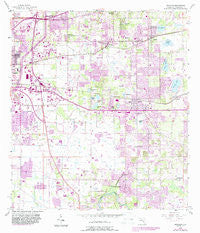
~ Brandon FL topo map, 1:24000 scale, 7.5 X 7.5 Minute, Historical, 1956, updated 1987
Brandon, Florida, USGS topographic map dated 1956.
Includes geographic coordinates (latitude and longitude). This topographic map is suitable for hiking, camping, and exploring, or framing it as a wall map.
Printed on-demand using high resolution imagery, on heavy weight and acid free paper, or alternatively on a variety of synthetic materials.
Topos available on paper, Waterproof, Poly, or Tyvek. Usually shipping rolled, unless combined with other folded maps in one order.
- Product Number: USGS-5622534
- Free digital map download (high-resolution, GeoPDF): Brandon, Florida (file size: 13 MB)
- Map Size: please refer to the dimensions of the GeoPDF map above
- Weight (paper map): ca. 55 grams
- Map Type: POD USGS Topographic Map
- Map Series: HTMC
- Map Verison: Historical
- Cell ID: 5263
- Scan ID: 345293
- Imprint Year: 1987
- Woodland Tint: Yes
- Photo Revision Year: 1987
- Aerial Photo Year: 1984
- Edit Year: 1987
- Survey Year: 1956
- Datum: NAD27
- Map Projection: Polyconic
- Map published by United States Geological Survey
- Map Language: English
- Scanner Resolution: 600 dpi
- Map Cell Name: Brandon
- Grid size: 7.5 X 7.5 Minute
- Date on map: 1956
- Map Scale: 1:24000
- Geographical region: Florida, United States
Neighboring Maps:
All neighboring USGS topo maps are available for sale online at a variety of scales.
Spatial coverage:
Topo map Brandon, Florida, covers the geographical area associated the following places:
- Sheffield East - Seffner - Buffalo Estates - Taylor Bay Estates - Lynwood Park - Pavilion Phase 3 - Brandon Mobile Estates - Vista Cay - Sylvan Terrace - Mango Hills - Branda Vista - Victoria Place - Eureka Homes - Brandon Brook Plaza - Glen Oaks South - Missouri Park - Limona - Kingsway Gardens - Keebler - Krebs - Green Ridge Estates - Villages of Lake Saint Charles - Colonial Oaks - Lynnhaven - Winston Manor - Valrico Lake - Abbey Trace - Fishers Farms - Mirror Lake - Delaney Creek Estates - Bryan Oaks Reserve - Meadow Woods Reserve - Green Meadow Estates - Murray Acres - Ivy Estates - Windwood Hills - Oak Mont - Jacobs Place - Oakbriar - Williams Crossing - Scenic Heights - Melodie Park - Countryside Manor - Shady Hollow - Butler Acres - Mango Groves - Lake Shore Ranch - Echo Acres - Brandon Terrace Park - Pine Grove Reserve - Nita Estates - Sunway - Windhorst Village - Oakwood Knoll - Sunrise Manor - Lakewood Ridge Estates North - Hillcrest - Rolling Meadows - Brandon Forest Reserve - Buffalo Avenue Farms - Brandon Oaks - Providence Lakes - Happy Homes - Speedway Park - Brandon Gardens - Oakwood Heights - Royal Oaks - Belle Timbre - Hidden Forest - Chestnut Forest - Orangeland - Cashin Oaks - Sanson Park - Hollington Oaks - Cien Fuegos - Bloomingdale Villas - Carrollton - Mango - Ridge Court - Cottagewood Oaks - Eleven Mile Hill - Clair-Mel City - Oakwood Ravine - Brentwood Hills - Mango Terrace - Eden Wood - Casa de Sol - The Willows - Brandon Village - Frye - Valrico Vista - Brandon Tradewinds - Jess Walden Oaks - Oaks at Valrico - Montclair Meadow - Melanie Manor - Westwood - Causeway Manor - Larrie Ellen Park - Buckingham Place
- Map Area ID: AREA2827.875-82.375-82.25
- Northwest corner Lat/Long code: USGSNW28-82.375
- Northeast corner Lat/Long code: USGSNE28-82.25
- Southwest corner Lat/Long code: USGSSW27.875-82.375
- Southeast corner Lat/Long code: USGSSE27.875-82.25
- Northern map edge Latitude: 28
- Southern map edge Latitude: 27.875
- Western map edge Longitude: -82.375
- Eastern map edge Longitude: -82.25


