
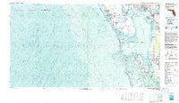
~ Charlotte Harbor FL topo map, 1:100000 scale, 30 X 60 Minute, Historical, 1981, updated 1983
Charlotte Harbor, Florida, USGS topographic map dated 1981.
Includes geographic coordinates (latitude and longitude). This topographic map is suitable for hiking, camping, and exploring, or framing it as a wall map.
Printed on-demand using high resolution imagery, on heavy weight and acid free paper, or alternatively on a variety of synthetic materials.
Topos available on paper, Waterproof, Poly, or Tyvek. Usually shipping rolled, unless combined with other folded maps in one order.
- Product Number: USGS-5621562
- Free digital map download (high-resolution, GeoPDF): Charlotte Harbor, Florida (file size: 34 MB)
- Map Size: please refer to the dimensions of the GeoPDF map above
- Weight (paper map): ca. 55 grams
- Map Type: POD USGS Topographic Map
- Map Series: HTMC
- Map Verison: Historical
- Cell ID: 67274
- Scan ID: 345465
- Imprint Year: 1983
- Woodland Tint: Yes
- Aerial Photo Year: 1979
- Edit Year: 1981
- Datum: NAD27
- Map Projection: Universal Transverse Mercator
- Map published by United States Geological Survey
- Map Language: English
- Scanner Resolution: 600 dpi
- Map Cell Name: Charlotte Harbor
- Grid size: 30 X 60 Minute
- Date on map: 1981
- Map Scale: 1:100000
- Geographical region: Florida, United States
Neighboring Maps:
All neighboring USGS topo maps are available for sale online at a variety of scales.
Spatial coverage:
Topo map Charlotte Harbor, Florida, covers the geographical area associated the following places:
- Harbor View - Bay Palms Mobile Home Park - Harbor View Mobile Home Park - Anchorage Mobile Home Park - Matlacha Shores - Pirate Harbor - Cayo Pelau - Fishermens Village - El Jobean - Manasota Key - Buttonwood Village Mobile Home Park - Palmetto Mobile Home Park - Cape Haze - Slip - Not Mobile Home Park - Pineland - Harbor Lakes Mobile Home Park - Mary Lu Mobile Home Park - Punta Gorda Beach - Rotonda - Maple Leaf Estates Mobile Home Park - Mobile Gardens - Punta Gorda - Placida - Englewood - Sancassa - Grove City - Punta Gorda Isles - Pink Citrus Mobile Home Park - Gasparilla - Gulf to Bay Cooperative Mobile Home Park - Upper Captiva - Burnt Store Lakes - Harbour Heights - Solana - Lakewood Village Mobile Home Park - Boca Grande - Bokeelia - Tee and Green Estates - Flamingo Bay - New Point Comfort - Rotunda-West - Captiva - Port Boca Grande - Aqui Esta - Acline - Shaefer - Charlotte Harbor - River Forest Village Mobile Home Park - Matlacha - Emerald Lake Mobile Home Community - Pine Island Center - Pine Island Cove Mobile Home Park - Deer Creek Mobile Home Park - Vizcaya Lakes - Matlacha Isles - Port Charlotte - Burnt Store Marina - Charlotte Park - Riviera Lagoons - Cayo Costa - Burnt Store Colony Mobile Home Park
- Map Area ID: AREA2726.5-83-82
- Northwest corner Lat/Long code: USGSNW27-83
- Northeast corner Lat/Long code: USGSNE27-82
- Southwest corner Lat/Long code: USGSSW26.5-83
- Southeast corner Lat/Long code: USGSSE26.5-82
- Northern map edge Latitude: 27
- Southern map edge Latitude: 26.5
- Western map edge Longitude: -83
- Eastern map edge Longitude: -82


