Europe, Executive, Tubed by National Geographic Maps
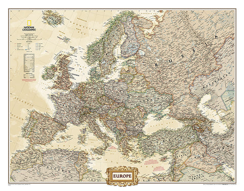
The Executive political map of Europe is a striking example of the cartographic excellence National Geographic is known for. The antique color palette, shaded relief, and easy-to-read fonts make this map both beautiful and functional. International boundaries are clearly defined and thousands of place names, waterbodies, airports, major highways and roads, national parks and more are included.
This map includes complete coverage of the countries and major cities of Albania, Armenia, Austria, Azerbaijan, Belarus, Belgium, Bosnia & Herzegovina, Bulgaria, Croatia, Cyprus, Czech Republic, Denmark, Estonia, Finland, France, Georgia, Germany, Greece, Hungary, Iceland, Ireland, Italy, Kosovo, Latvia, Liechtenstein, Lithuania, Luxembourg, Macedonia, Moldova, Montenegro, The Netherlands, Norway, Poland, Portugal, Romania, Russia, Serbia, Slovakia, Slovenia, Spain, Sweden, Switzerland, Turkey, Ukraine, and the United Kingdom.
The map is packaged in a 2-diameter clear plastic tube. The tube has a decorative label showing a thumbnail of the map with dimensions and other pertinent information.
- Product Number: 2030818M
- Product Code: NG_EUR_E_WA
- Publisher Product ID: RE0620323T
- ISBN: 9780792289838
- Year of Publication: 2013
- Unfolded Size: 20.47 x 27.36 inches
- Map type: Wall Map
- Geographical region: Europe