Europe, Classic, Laminated by National Geographic Maps
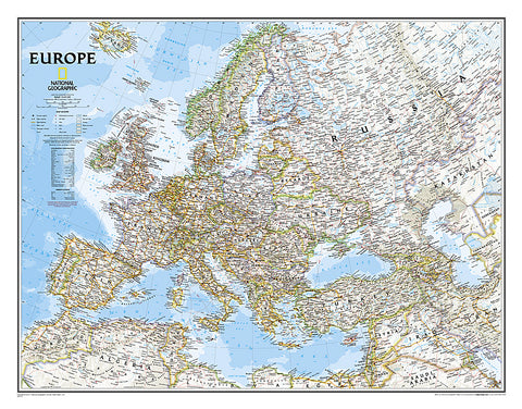
National Geographics Classic political map of Europe features clearly defined international boundaries, thousands of place names, waterbodies, airports, major highways and roads, national parks, and much more. The tasteful color palette, shaded relief, and coastal bathymetry make this map as attractive as it is functional. The countries and major cities shown include: Albania, Armenia, Austria, Azerbaijan, Belarus, Belgium, Bosnia & Herzegovina, Bulgaria, Croatia, Cyprus, Czech Republic, Denmark, Estonia, Finland, France, Georgia, Germany, Greece, Hungary, Iceland, Ireland, Italy, Kosovo, Latvia, Liechtenstein, Lithuania, Luxembourg, Macedonia, Moldova, Montenegro, The Netherlands, Norway, Poland, Portugal, Romania, Russia, Serbia, Slovakia, Slovenia, Spain, Sweden, Switzerland, Turkey, Ukraine, and the United Kingdom.
The map is encapsulated in heavy-duty 1.6 mil laminate which makes the paper much more durable and resistant to the swelling and shrinking caused by changes in humidity. Laminated maps can be framed without the need for glass
- Product Number: 2030815M
- Product Code: NG_EUR_LAM
- Publisher Product ID: RE00620147
- ISBN: 9780792250166
- Year of Publication: 2011
- Unfolded Size: 20.87 x 26.77 inches
- Map type: Wall Map
- Geographical region: Europe