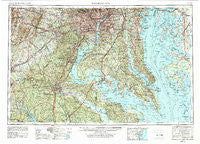
~ Washington DC topo map, 1:250000 scale, 1 X 2 Degree, Historical, 1957, updated 1979
Washington, District of Columbia, USGS topographic map dated 1957.
Includes geographic coordinates (latitude and longitude). This topographic map is suitable for hiking, camping, and exploring, or framing it as a wall map.
Printed on-demand using high resolution imagery, on heavy weight and acid free paper, or alternatively on a variety of synthetic materials.
Topos available on paper, Waterproof, Poly, or Tyvek. Usually shipping rolled, unless combined with other folded maps in one order.
- Product Number: USGS-5389874
- Free digital map download (high-resolution, GeoPDF): Washington, District of Columbia (file size: 27 MB)
- Map Size: please refer to the dimensions of the GeoPDF map above
- Weight (paper map): ca. 55 grams
- Map Type: POD USGS Topographic Map
- Map Series: HTMC
- Map Verison: Historical
- Cell ID: 69087
- Scan ID: 257791
- Imprint Year: 1979
- Woodland Tint: Yes
- Visual Version Number: 2
- Aerial Photo Year: 1976
- Edit Year: 1979
- Field Check Year: 1957
- Datum: Unstated
- Map Projection: Transverse Mercator
- Map published by United States Geological Survey
- Map Language: English
- Scanner Resolution: 600 dpi
- Map Cell Name: Washington
- Grid size: 1 X 2 Degree
- Date on map: 1957
- Map Scale: 1:250000
- Geographical region: District of Columbia, United States
Neighboring Maps:
All neighboring USGS topo maps are available for sale online at a variety of scales.
Spatial coverage:
Topo map Washington, District of Columbia, covers the geographical area associated the following places:
- Saint Jeromes Landing - Green Meadows - Branchville - Clinton Acres - Hampton - Rose Hill - Vienna - West End Farms - Treeland - Oak Grove - Blackwater - Barcroft Woods - Columbia Heights - North Indian Head Estates - Gordons Corner - Woodbine Woods - Maple Grove Estates - Massaponax - Bealeton - Edgewood - Nacotchtanke (historical) - Holly Oaks - Patuxent River Estates - Cox Corner - Pisgah - Bluestone Estates - Grays Corner - Foxhall Crescent - Carrico Mill Estates - Huntingtown Farms - Myrtle Grove Estates - Peach Blossom Heights - Hume - Arlington Forest - Chaney Station - Travis Mill - Sun Valley Estates - Dorchester - Breeden Forest - Oak Hill Estates - Norbourne Mobile Home Park - Mayfair-Parkside - Abell - Belleair - Galesville - Olde Forge - Bryan Point - Devon Park - The Estates - Deep Harbor Estates - Hinnom - Paris Oaks - Potomac Knolls - Holly Landing - Stefin Woods Estate - Rutland - Oakland - Grafton (historical) - Clifton - Mineral - Spring Ridge - Mastins Corner - Governor Grayson Manor - China Hill - Suitland - Barnaby Woods - Buzzard Point - Bywater Estates - Chickasaw Run - Hunter - White Plains Mobile Home Park - Oakshade - Massachusetts Avenue Heights - Brentwood Village - Trenton Place - Allnut - Weedonville - Etta - Green Meadows - Lakeland - Falls Church - Deale Beach - Woodland - Chillum - Heather Woods - Pleasant Ridge - Sudley - Rolling Knolls - Collison Corner - Arborview - Calvert Woods - Hart Division of Little Falls - Patuxent Manor - Perrys Corner - Wolf Trap - Christs Rock - Broyhill Forest - Long Beach - Antioch - Fenwick Manor
- Map Area ID: AREA3938-78-76
- Northwest corner Lat/Long code: USGSNW39-78
- Northeast corner Lat/Long code: USGSNE39-76
- Southwest corner Lat/Long code: USGSSW38-78
- Southeast corner Lat/Long code: USGSSE38-76
- Northern map edge Latitude: 39
- Southern map edge Latitude: 38
- Western map edge Longitude: -78
- Eastern map edge Longitude: -76