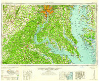
~ Washington DC topo map, 1:250000 scale, 1 X 2 Degree, Historical, 1961
Washington, District of Columbia, USGS topographic map dated 1961.
Includes geographic coordinates (latitude and longitude). This topographic map is suitable for hiking, camping, and exploring, or framing it as a wall map.
Printed on-demand using high resolution imagery, on heavy weight and acid free paper, or alternatively on a variety of synthetic materials.
Topos available on paper, Waterproof, Poly, or Tyvek. Usually shipping rolled, unless combined with other folded maps in one order.
- Product Number: USGS-5389864
- Free digital map download (high-resolution, GeoPDF): Washington, District of Columbia (file size: 19 MB)
- Map Size: please refer to the dimensions of the GeoPDF map above
- Weight (paper map): ca. 55 grams
- Map Type: POD USGS Topographic Map
- Map Series: HTMC
- Map Verison: Historical
- Cell ID: 69087
- Scan ID: 257785
- Woodland Tint: Yes
- Visual Version Number: 1
- Aerial Photo Year: 1944
- Datum: NAD27
- Map Projection: Transverse Mercator
- Map published by United States Geological Survey
- Map Language: English
- Scanner Resolution: 600 dpi
- Map Cell Name: Washington
- Grid size: 1 X 2 Degree
- Date on map: 1961
- Map Scale: 1:250000
- Geographical region: District of Columbia, United States
Neighboring Maps:
All neighboring USGS topo maps are available for sale online at a variety of scales.
Spatial coverage:
Topo map Washington, District of Columbia, covers the geographical area associated the following places:
- Snow Hill - Holly Tree Park - Ginger Cove - Georgetown - Chaple - Sandyland Beach - Autumn Chase at Riva Trace - White Owl Landing - Mount Ringold Farm - Jersey - Lancaster Hill - Smoky - Camelot - Bull Run Mobile Home Park - Brooke Ridge - Western Shore Estates - Terre Grande - Home Place - Nomini Grove - Rock Point - Vestavia Woods - Gibson Meadows - Loch Lomond - Hillcrest Estates - Rays Point - Chapel Knoll - Forestville - Brookwood Estates - Rosewood - Benedict Smiths - Antioch - West Beach - Kings Crossroads - Fort Lincoln New Town - Summerset Ridge - Argyle Hills - Hill Top - Bowie - Morrisons Corner - Spring Cove - Gypsum Hill Estates - Colonial Beach - Weedonville - South Down Shores - Fox Den - Parole - Sunrise Acres - River Oaks - Pomfret Estates - Lindau Woods - Defense Heights - Arrowhead Farms Estates - Walton - Elkwood - J A Macgregor Estate - Gum Landing - Chevy Chase Section 4 - Mockingbird Ridge - Hazel Hill - Swan Villas - Dunn Loring Woods - Avondale Terrace - Belle Haven - Bon Haven - Little Run Estates - Ivytown - South River - Litchfield - China Hill - Lee's Hill Mobile Home Park - York manor - Willow Woods - Dover - Gayles - Greenfield - Fairfax Hills - Westlake Village - Seward - Park Ridge - Glymont - Presidential Lakes - Butts Corner - Hinnom - Berea - Hickory Hills - Brad Lee - Bloomsbury Square - Norwood Hills - Seashore Beach - Graham Park Shores - Grasonville - Belleair - Waterfall - Chiltons - Cookes Park - Mount Pleasant - West Lanham Hills - Princedale - Highland Beach - Lewinsville Heights
- Map Area ID: AREA3938-78-76
- Northwest corner Lat/Long code: USGSNW39-78
- Northeast corner Lat/Long code: USGSNE39-76
- Southwest corner Lat/Long code: USGSSW38-78
- Southeast corner Lat/Long code: USGSSE38-76
- Northern map edge Latitude: 39
- Southern map edge Latitude: 38
- Western map edge Longitude: -78
- Eastern map edge Longitude: -76