~ Washington West DC topo map, 1:24000 scale, 7.5 X 7.5 Minute, Historical, 1965, updated 1980
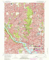
Washington West, District of Columbia, USGS topographic map dated 1965.
Includes geographic coordinates (latitude and longitude). This topographic map is suitable for hiking, camping, and exploring, or framing it as a wall map.
Printed on-demand using high resolution imagery, on heavy weight and acid free paper, or alternatively on a variety of synthetic materials.
Topos available on paper, Waterproof, Poly, or Tyvek. Usually shipping rolled, unless combined with other folded maps in one order.
- Product Number: USGS-5389844
- Free digital map download (high-resolution, GeoPDF): Washington West, District of Columbia (file size: 23 MB)
- Map Size: please refer to the dimensions of the GeoPDF map above
- Weight (paper map): ca. 55 grams
- Map Type: POD USGS Topographic Map
- Map Series: HTMC
- Map Verison: Historical
- Cell ID: 47611
- Scan ID: 256987
- Imprint Year: 1980
- Woodland Tint: Yes
- Photo Revision Year: 1980
- Aerial Photo Year: 1977
- Edit Year: 1980
- Field Check Year: 1956
- Datum: NAD27
- Map Projection: Polyconic
- Map published by United States Geological Survey
- Map Language: English
- Scanner Resolution: 600 dpi
- Map Cell Name: Washington West
- Grid size: 7.5 X 7.5 Minute
- Date on map: 1965
- Map Scale: 1:24000
- Geographical region: District of Columbia, United States
Neighboring Maps:
All neighboring USGS topo maps are available for sale online at a variety of scales.
Spatial coverage:
Topo map Washington West, District of Columbia, covers the geographical area associated the following places:
- Friendship Heights - Georgetown Heights (historical) - Green Acres - Cathedral Heights - Sheridan-Kalorama - Foxhall Crescent - Friendship Village - Chillum Station - Clarendon - Manor Park - Springfield - Arlingwood - Broyhill Forest - Radnor Heights - Battery Park - Glenwood - West End - Dobbins Addition (historical) - Greenwich Forest - Bradley Hills - Dupont Circle - English Village - Rosslyn - Widowsville (historical) - Highlands - Park View - Adams Morgan - Woodmont - Colony Hill - Kalorama Heights - Glenbrook - Fernwood Heights (historical) - Georgetown - Washington City - North Takoma Park - Cleveland Park - Mount Vernon Square - Chevy Chase Heights - Forest Hills - Hamburgh (historical) - Northwest Rectangle - Westchester - Crystal Spring Knolls - Shaw - Bethesda - Riverwood - Rollingwood - Armsleigh Park (historical) - Harlem (historical) - Columbia Forest - Westboro - Blair Portal - Robeyville (historical) - Park Place - Somerset - Foggy Bottom - Brandon Village - Westgate - Westover Place - Chevy Chase Village - Chevy Chase Section 4 - Wood Acres - Lanier Heights - The Cloisters - Wesley Heights - Sumner - West Chevy Chase Heights - Bloomingdale - Westminster - East Central - Edgewood - Fairview Heights (historical) - Crestview - Pretty Prospect (historical) - Huntington Terrace - Bradmoor - Drummond - Foxhall Terrace - Farragut Square - Arlington - McLean Gardens - Lewis Subdivision (historical) - Foxhall - Columbia Heights - Eckington - Shepherd Park - Landon Village - Lyon Park - Rock Creek Gardens - Hampshire Knolls - Cherrydale - High Point - Bellevue Forest - Reno - Metropolis View - The Hamlet - Sligo Park Hills - Pinehurst Circle - Kalorama Triangle - Chevy Chase
- Map Area ID: AREA3938.875-77.125-77
- Northwest corner Lat/Long code: USGSNW39-77.125
- Northeast corner Lat/Long code: USGSNE39-77
- Southwest corner Lat/Long code: USGSSW38.875-77.125
- Southeast corner Lat/Long code: USGSSE38.875-77
- Northern map edge Latitude: 39
- Southern map edge Latitude: 38.875
- Western map edge Longitude: -77.125
- Eastern map edge Longitude: -77