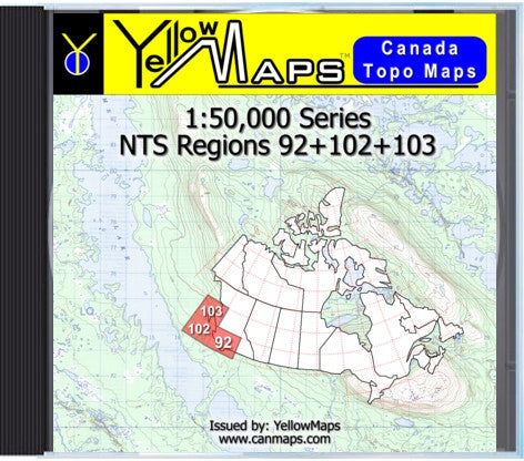
YellowMaps Canada Topo Maps: NTS Regions 92+102+103
These digital topographic maps are exact copies of Canadian federal government topographic maps, produced under licence from Natural Resources Canada.
Each Data-DVD volume contains all topographic maps available from Natural Resources Canada for the area shown.
You can access the raw images files in jpeg format. You can view and work with these maps just as you would work with digital photographs, using any image editing software.
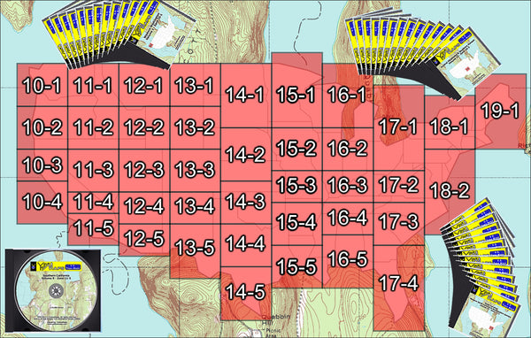
* Coverage: NTS Regions 92 102 103
* General area: southern British Columbia, western British Columbia
* 314 topographic maps
* 1:50,000 scale
* National Topographic System of Canada maps
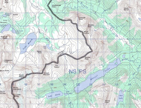
* View Sample Map
* JPEG images on Data-DVD
System Requirements
* PC or Mac
* DVD drive
* 500 MHz processor or better
* 512 MB RAM (Recommended: 1 GB)
* 256 color display or better
* Mouse or other pointing device
Each Data-DVD volume contains all topographic maps available from Natural Resources Canada for the area shown.
You can access the raw images files in jpeg format. You can view and work with these maps just as you would work with digital photographs, using any image editing software.
* Coverage: NTS Regions 92 102 103
* General area: southern British Columbia, western British Columbia
* 314 topographic maps
* 1:50,000 scale
* National Topographic System of Canada maps
* View Sample Map
* JPEG images on Data-DVD
System Requirements
* PC or Mac
* DVD drive
* 500 MHz processor or better
* 512 MB RAM (Recommended: 1 GB)
* 256 color display or better
* Mouse or other pointing device