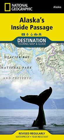
Alaskas Inside Passage DestinationMap by National Geographic Maps
• Waterproof • Tear-Resistant • Travel Map
Explore the exhilarating majesty and mystique of Southeast Alaska with National Geographics Alaskas Inside Passage Destination Map. The Inside Passage is a meandering waterway formed by a myriad of islands that lie between the North Pacific Ocean and the quieter waters along the coast. At its heart is the Tongass National Forest, the largest national forest in the United States which at a staggering 16.8 million acres contains 19 designated wilderness areas and the Admiralty Island and Misty Fiords National Monuments.
This remarkable region of Alaska boasts unparalleled scenery and countless opportunities to experience some of Alaskas most amazing and diverse wildlife as well as its rich native culture and history. Visitors can view the ever-changing landscape of Glacier Bay from passenger ships or wind through Tongass National Forest in a sea kayak. Few roads exist in the region so travel is mainly done by boat or seaplane, both of which allow for a greater opportunity to absorb the icy peaks, spruce-hemlock rain forests, and azure waters.
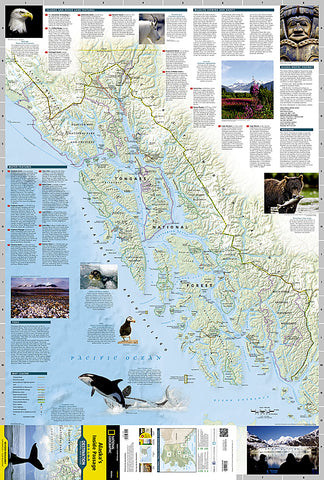
The front side of Alaskas Inside Passage reveals a striking map of the region from the northern reaches of Glacier Bay National Park and Preserve south to Prince of Wales Island. Information about the islands and other land features, wildlife viewing and safety, the weather, the tides and more is included.
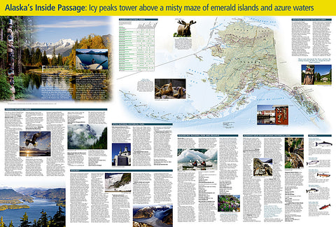
The reverse side of the map provides invaluable content for travelers with extensive descriptions of points of interest and information about tours, outfitters, visitor associations, lodging, the geology of the region, and local indigenous cultures. A National Parks chart includes services offered and contact information for each park, and an additional map of the entire state of Alaska provides context for the region.
Key Features:
Chart of Alaskas national parks including services and contact information
Colorful photographs and information about some of the regions diverse wildlife
Alaska Marine Highway, state and provincial highways, and sites for scheduled air or seaplane service
National parks and monuments, wildlife refuges, and wilderness areas
Detailed information about tides, weather, water features, wildlife viewing and safety, native cultures, geology, and more
Descriptive content about Tongass National Forest, Klondike Gold Rush National Historical Park, Glacier Bay National Park and Preserve, and Sitka National Historical Park
Every Destination Map is printed on durable synthetic paper, making them waterproof, tear-resistant and tough - capable of withstanding the rigors of any kind of travel.
Map Scale = 1:880,000
- Product Number: 2056444M
- Product Code: NG_DM_AK_IP
- Publisher Product ID: DM01020629
- ISBN: 9781597754514
- Year of Publication: 2015
- Folded Size: 9.45 x 4.33 inches
- Unfolded Size: 32.68 x 24.8 inches
- Map type: Folded Map
- Geographical region: Alaska