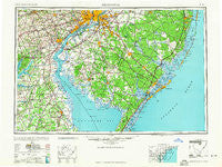
~ Wilmington DE topo map, 1:250000 scale, 1 X 2 Degree, Historical, 1959
Wilmington, Delaware, USGS topographic map dated 1959.
Includes geographic coordinates (latitude and longitude). This topographic map is suitable for hiking, camping, and exploring, or framing it as a wall map.
Printed on-demand using high resolution imagery, on heavy weight and acid free paper, or alternatively on a variety of synthetic materials.
Topos available on paper, Waterproof, Poly, or Tyvek. Usually shipping rolled, unless combined with other folded maps in one order.
- Product Number: USGS-5390394
- Free digital map download (high-resolution, GeoPDF): Wilmington, Delaware (file size: 17 MB)
- Map Size: please refer to the dimensions of the GeoPDF map above
- Weight (paper map): ca. 55 grams
- Map Type: POD USGS Topographic Map
- Map Series: HTMC
- Map Verison: Historical
- Cell ID: 69102
- Scan ID: 255820
- Woodland Tint: Yes
- Aerial Photo Year: 1943
- Datum: NAD27
- Map Projection: Transverse Mercator
- Map published by United States Army
- Map Language: English
- Scanner Resolution: 600 dpi
- Map Cell Name: Wilmington
- Grid size: 1 X 2 Degree
- Date on map: 1959
- Map Scale: 1:250000
- Geographical region: Delaware, United States
Neighboring Maps:
All neighboring USGS topo maps are available for sale online at a variety of scales.
Spatial coverage:
Topo map Wilmington, Delaware, covers the geographical area associated the following places:
- Bel Hill (historical) - Morrisville - El Paco Farms - Saint Georges - Oakridge - Grendon Farms - Monterey Beach - Kemblesville - Rulon Road - The Plains - Coffee Run - Surrey Place - Springville - North Hills - West Egg Harbor - Glasgow Court - Leeds Point - Munion Field - Underwood Corner - Goshen Commons - Norway - Turnersville - Grays Ferry - Marcus Hook - Avondale - Red Lion - Woodville - South Penns Grove - Riverside - Glen Mary Heights - Colwick - Broad Lane - Murray Grove - Concord Manor - Coxstown - Zurkow Development - Burleigh - Bellmawr - Harmony - Island Heights - Monterey Farms - Pine Springs Mobile Home Park - Belford Manor - Sheriden - Old Mill Manor - Bank (historical) - Locksley Crossing - Mockingbird Hills - Long Beach - Hacks Point Acres - East Lake - Heritage Valley - North East Harbor - Cobblestones at Thornbury - Creesville - Cooper Village - Whitman Park - Redmont - Airmont Acres - Independence Village - Spring Valley - Woodbrook - White House Landing - Morgan Village - Wexford East - Edgebrooke - Cleaves Fork - Whispering Pines Mobile Home Park - Barnard - Fishing Creek - Trepagnier - East Lake Gardens - Delaware Junction - Summer Hill - Union Mills - Staffordville - Northville - Okehocking Hills - Forest Green Court - Stone Harbor Manor - Hephzibah - Mantua - Ogletown - Snug Harbor - Toms River - Barnegat Bay Estates - Scotch Bonnet - Memel Farms - Lincoln Park - Village of Valleybrook - Brandywood - Tuckerton Shores - Presidential Lake Estates - Century Farms - Whiting - Ward - Ludlow - Montchanin - Northshire - Carroll Park
- Map Area ID: AREA4039-76-74
- Northwest corner Lat/Long code: USGSNW40-76
- Northeast corner Lat/Long code: USGSNE40-74
- Southwest corner Lat/Long code: USGSSW39-76
- Southeast corner Lat/Long code: USGSSE39-74
- Northern map edge Latitude: 40
- Southern map edge Latitude: 39
- Western map edge Longitude: -76
- Eastern map edge Longitude: -74

