![Buy map Cuba Classic Wall Map [Laminated]](http://store.yellowmaps.com/cdn/shop/products/big_2f96829c-af59-4b35-b1f2-9f6811803456_large.jpg?v=1706689196)
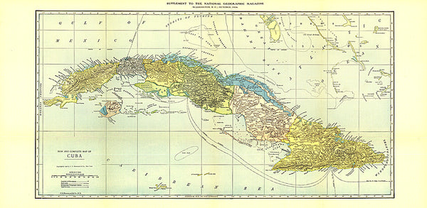
Cuba Classic Wall Map [Laminated]
National Geographics signature Classic style map of Cuba uses a bright and vibrant color palette featuring stunning shaded relief and ocean bathymetry. Pinpointed on the map are thousands of cities and towns, national parks, mountains, swamps, coral reefs and islands of the archipelago. In addition, major infrastructure networks are displayed, including highways, roads, railroads, oil fields and pipelines, airports, canals and ferry routes. Jamaica, the Cayman Islands, the Florida Keys, and most of the Bahamas and Haiti are shown, along with the Gulf of Mexico, Caribbean Sea, Atlantic Ocean and Straits of Florida. A user-friendly index shows the English translation for many geographic terms.
The map is encapsulated in heavy-duty 1.6 mil laminate which makes the paper much more durable and resistant to the swelling and shrinking caused by changes in humidity. Laminated maps can be framed without the need for glass.
- Product Number: NG_CUB_LA_13
- Reference Product Number: 2127843M
- ISBN: 9781597754385
- Date of Publication: 6/1/2013
- Unfolded (flat) Size: 36.02 inches high by 24.02 inches wide
- Map format: Wall
- Map type: Trade Maps - Political
- Geographical region: Cuba