
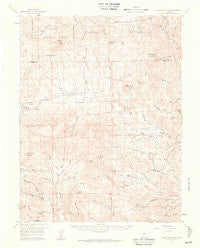
~ Black Mountain CO topo map, 1:62500 scale, 15 X 15 Minute, Historical, 1959, updated 1961
Black Mountain, Colorado, USGS topographic map dated 1959.
Includes geographic coordinates (latitude and longitude). This topographic map is suitable for hiking, camping, and exploring, or framing it as a wall map.
Printed on-demand using high resolution imagery, on heavy weight and acid free paper, or alternatively on a variety of synthetic materials.
Topos available on paper, Waterproof, Poly, or Tyvek. Usually shipping rolled, unless combined with other folded maps in one order.
- Product Number: USGS-5358045
- Free digital map download (high-resolution, GeoPDF): Black Mountain, Colorado (file size: 5 MB)
- Map Size: please refer to the dimensions of the GeoPDF map above
- Weight (paper map): ca. 55 grams
- Map Type: POD USGS Topographic Map
- Map Series: HTMC
- Map Verison: Historical
- Cell ID: 51449
- Scan ID: 402317
- Imprint Year: 1961
- Visual Version Number: 2
- Aerial Photo Year: 1954
- Field Check Year: 1959
- Datum: NAD27
- Map Projection: Polyconic
- Map published by United States Geological Survey
- Map Language: English
- Scanner Resolution: 508 dpi
- Map Cell Name: Black Mountain
- Grid size: 15 X 15 Minute
- Date on map: 1959
- Map Scale: 1:62500
- Geographical region: Colorado, United States
Neighboring Maps:
All neighboring USGS topo maps are available for sale online at a variety of scales.
Spatial coverage:
Topo map Black Mountain, Colorado, covers the geographical area associated the following places:
- Mullock Gulch - Thorne Mine - I M Ranch - Poncha Park - Russell Ranch - Cottonwood Detention Dam 1 - Charlene Number One Mine - Southern Park County Fire Protection District Station 3 Pike Trails - Stoney Face Mountain - West Waugh Creek - Tallahassee Volunteer Fire Protection Station 3 - Black Mountain - North Tallahassee Creek - Tallahassee School - Glen Williams Mine - Waugh Mountain - Tallahassee Volunteer Fire Protection Station 1 - Quagmire Creek - Dry Gulch - Louis Gulch - North Burno Mountain - Meyers Ranch Mine - Fear Creek - Baldy Mountain - V V N Ranch - Thorn Ranch - R Taylor Ranch - Delilah Peak - Freshwater Creek - Glen Williams Mine - Hall Gulch - Red Hill - Table Mountain - Green Mountain Gulch - Burris Mountain - Waugh Gulch - Thirtyone Mile Creek - North Waugh Creek - Green Mountain - Cabin Gulch - Paris Creek - Dickson-Snooper Mine - East Antelope Mountain - Stirrup Ranch - Miller Creek - Mary L Group Mine - West Antelope Mountain - Squaw Creek - Soapy Hill - Kelly Creek - Meadow Gulch - Taylor Soda Spring - Hammond Peak - Little Abner Number One Mine - Betty Mine - Christopher Ranch - Salt Creek - H Taylor Ranch - Galster Gulch - Yellow Soda Spring - Middle Tallahassee Creek - Tallahassee Volunteer Fire Protection Station 2 - Loco Mountain - Wall Mountain - Spring Gulch - Warmer Gulch - Joan Two Mine - Thirtyone Mile Mountain
- Map Area ID: AREA38.7538.5-105.75-105.5
- Northwest corner Lat/Long code: USGSNW38.75-105.75
- Northeast corner Lat/Long code: USGSNE38.75-105.5
- Southwest corner Lat/Long code: USGSSW38.5-105.75
- Southeast corner Lat/Long code: USGSSE38.5-105.5
- Northern map edge Latitude: 38.75
- Southern map edge Latitude: 38.5
- Western map edge Longitude: -105.75
- Eastern map edge Longitude: -105.5


