
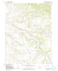
~ Vermillion Mesa CO topo map, 1:24000 scale, 7.5 X 7.5 Minute, Historical, 1966, updated 1992
Vermillion Mesa, Colorado, USGS topographic map dated 1966.
Includes geographic coordinates (latitude and longitude). This topographic map is suitable for hiking, camping, and exploring, or framing it as a wall map.
Printed on-demand using high resolution imagery, on heavy weight and acid free paper, or alternatively on a variety of synthetic materials.
Topos available on paper, Waterproof, Poly, or Tyvek. Usually shipping rolled, unless combined with other folded maps in one order.
- Product Number: USGS-5357277
- Free digital map download (high-resolution, GeoPDF): Vermillion Mesa, Colorado (file size: 12 MB)
- Map Size: please refer to the dimensions of the GeoPDF map above
- Weight (paper map): ca. 55 grams
- Map Type: POD USGS Topographic Map
- Map Series: HTMC
- Map Verison: Historical
- Cell ID: 46793
- Scan ID: 234849
- Imprint Year: 1992
- Woodland Tint: Yes
- Photo Inspection Year: 1973
- Aerial Photo Year: 1965
- Field Check Year: 1966
- Datum: NAD27
- Map Projection: Lambert Conformal Conic
- Map published by United States Geological Survey
- Map Language: English
- Scanner Resolution: 600 dpi
- Map Cell Name: Vermillion Mesa
- Grid size: 7.5 X 7.5 Minute
- Date on map: 1966
- Map Scale: 1:24000
- Geographical region: Colorado, United States
Neighboring Maps:
All neighboring USGS topo maps are available for sale online at a variety of scales.
Spatial coverage:
Topo map Vermillion Mesa, Colorado, covers the geographical area associated the following places:
- Teds Draw - Willow Spring - Hughes Flat - Sager Draw - Martin Draw - Hartman Draw - Hughes Spring - Kurth Draw - Loomis Spring - Big Bend Draw - Hefley Cabin - Thomas Draw - Kraft Draw - Hughes Cemetery - Talamantes Creek - Vermillion Mesa - West Boone Draw - Langley Draw - Lefthand Draw - Dry Knob
- Map Area ID: AREA40.7540.625-108.75-108.625
- Northwest corner Lat/Long code: USGSNW40.75-108.75
- Northeast corner Lat/Long code: USGSNE40.75-108.625
- Southwest corner Lat/Long code: USGSSW40.625-108.75
- Southeast corner Lat/Long code: USGSSE40.625-108.625
- Northern map edge Latitude: 40.75
- Southern map edge Latitude: 40.625
- Western map edge Longitude: -108.75
- Eastern map edge Longitude: -108.625


