
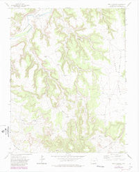
~ Beaty Canyon CO topo map, 1:24000 scale, 7.5 X 7.5 Minute, Historical, 1972, updated 1985
Beaty Canyon, Colorado, USGS topographic map dated 1972.
Includes geographic coordinates (latitude and longitude). This topographic map is suitable for hiking, camping, and exploring, or framing it as a wall map.
Printed on-demand using high resolution imagery, on heavy weight and acid free paper, or alternatively on a variety of synthetic materials.
Topos available on paper, Waterproof, Poly, or Tyvek. Usually shipping rolled, unless combined with other folded maps in one order.
- Product Number: USGS-5346693
- Free digital map download (high-resolution, GeoPDF): Beaty Canyon, Colorado (file size: 7 MB)
- Map Size: please refer to the dimensions of the GeoPDF map above
- Weight (paper map): ca. 55 grams
- Map Type: POD USGS Topographic Map
- Map Series: HTMC
- Map Verison: Historical
- Cell ID: 2893
- Scan ID: 400343
- Imprint Year: 1985
- Woodland Tint: Yes
- Visual Version Number: 1
- Photo Revision Year: 1984
- Aerial Photo Year: 1983
- Edit Year: 1984
- Datum: NAD27
- Map Projection: Lambert Conformal Conic
- Map published by United States Geological Survey
- Map Language: English
- Scanner Resolution: 508 dpi
- Map Cell Name: Beaty Canyon
- Grid size: 7.5 X 7.5 Minute
- Date on map: 1972
- Map Scale: 1:24000
- Geographical region: Colorado, United States
Neighboring Maps:
All neighboring USGS topo maps are available for sale online at a variety of scales.
Spatial coverage:
Topo map Beaty Canyon, Colorado, covers the geographical area associated the following places:
- Reed Dam - Goat Ranch Dam - Round Prairie - Vaya Windmill - Goat Canyon - Camp Windmill - Lower Beaty Windmill - Sumpter Spring - Window Rock - Little Beaty Canyon - Clark Hill - Twin Windmills - Fritz Spring - Beaty Canyon - Trail Dam - Red Bench Windmill - Piñon Park Hill - Goat Ranch Spring - Little Beaty Dam - Telephone Dam - Padilla Windmill - Picture Window - South Canyon - South Vaya Dam - Dunbar Dam - East Dam - Piñon Park - Road Dam - Sixteen Windmill - Little Windmill - West Red Bench Windmill - Northwest Dam - West Vaya Dam
- Map Area ID: AREA37.62537.5-103.625-103.5
- Northwest corner Lat/Long code: USGSNW37.625-103.625
- Northeast corner Lat/Long code: USGSNE37.625-103.5
- Southwest corner Lat/Long code: USGSSW37.5-103.625
- Southeast corner Lat/Long code: USGSSE37.5-103.5
- Northern map edge Latitude: 37.625
- Southern map edge Latitude: 37.5
- Western map edge Longitude: -103.625
- Eastern map edge Longitude: -103.5


