
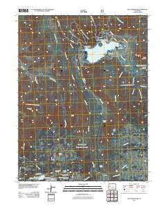
~ Vega Reservoir CO topo map, 1:24000 scale, 7.5 X 7.5 Minute, Historical, 2011
Vega Reservoir, Colorado, USGS topographic map dated 2011.
Includes geographic coordinates (latitude and longitude). This topographic map is suitable for hiking, camping, and exploring, or framing it as a wall map.
Printed on-demand using high resolution imagery, on heavy weight and acid free paper, or alternatively on a variety of synthetic materials.
Topos available on paper, Waterproof, Poly, or Tyvek. Usually shipping rolled, unless combined with other folded maps in one order.
- Product Number: USGS-5241241
- Free digital map download (high-resolution, GeoPDF): Vega Reservoir, Colorado (file size: 31 MB)
- Map Size: please refer to the dimensions of the GeoPDF map above
- Weight (paper map): ca. 55 grams
- Map Type: POD USGS Topographic Map
- Map Series: US Topo
- Map Verison: Historical
- Cell ID: 44747
- Datum: North American Datum of 1983
- Map Projection: Transverse Mercator
- Map Cell Name: Vega Reservoir
- Grid size: 7.5 X 7.5 Minute
- Date on map: 2011
- Map Scale: 1:24000
- Geographical region: Colorado, United States
Neighboring Maps:
All neighboring USGS topo maps are available for sale online at a variety of scales.
Spatial coverage:
Topo map Vega Reservoir, Colorado, covers the geographical area associated the following places:
- Erie Canal - McKelvie Number 1 Dam - Goody Spring - Big Park - Leon Cow Camp - West Salt Creek - Vega Dam - Power and Water Resources Office - Aspen Grove Campground - Two Creek - East Salt Creek - Kirkendall Flats - Ranger Creek - McKelvie Reservoir Number 1 - Grove Creek Reservoir Number 1 - Campbell Mountain - Big Creek Leon Drift Fence - Grove Creek Reservoir Number 2 - Labbe Reservoir - Leon Creek - Park Creek - Youngs Creek - Vega Reservoir - Sheep Flats - Rock Lake - Vega State Recreation Area - Hads Point - Wilson Creek - Boque Mountain - Swede Flats - Vega Lodge - Grove Creek Number 2 Dam - Grove Creek Number 1 Dam - Anne Holland Creek - Department of Parks and Outdoor Recreation Office - Sugarloaf Peak - Anderson Brothers Reservoir - Anderson Brothers Reservoir Number 1 - The Meadows (historical) - Anderson Brothers Number 1 Dam
- Map Area ID: AREA39.2539.125-107.875-107.75
- Northwest corner Lat/Long code: USGSNW39.25-107.875
- Northeast corner Lat/Long code: USGSNE39.25-107.75
- Southwest corner Lat/Long code: USGSSW39.125-107.875
- Southeast corner Lat/Long code: USGSSE39.125-107.75
- Northern map edge Latitude: 39.25
- Southern map edge Latitude: 39.125
- Western map edge Longitude: -107.875
- Eastern map edge Longitude: -107.75


